 |
|
|
 |
(Click on the photo to enlarge) |
Location & QuickFacts
| FAA Information Effective: | 2008-09-25 |
| Airport Identifier: | B70 |
| Airport Status: | Operational |
| Longitude/Latitude: | 111-06-32.9080W/48-18-49.9350N
-111.109141/48.313871 (Estimated) |
| Elevation: | 3023 ft / 921.41 m (Estimated) |
| Land: | 20 acres |
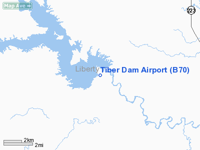
| From nearest city: | 1 nautical miles SW of Tiber Dam, MT |
| Location: | Liberty County, MT |
| Magnetic Variation: | 17E (1985) |
Owner & Manager
| Ownership: | Publicly owned |
| Owner: | Montana Aeronautics Div |
| Address: | Po Box 200507
Helena, MT 59620-0507 |
| Phone number: | 406-444-2506 |
| Manager: | Montana Aeronautics Division |
| Address: | Po Box 200507
Helena, MT 59620-0507 |
| Phone number: | 406-444-2506 |
Airport Operations and Facilities
| Airport Use: | Open to public |
| Wind indicator: | Yes |
| Segmented Circle: | Yes |
| Control Tower: | No |
| Sectional chart: | Great Falls |
| Region: | ANM - Northwest Mountain |
| Boundary ARTCC: | ZLC - Salt Lake City |
| Tie-in FSS: | GTF - Great Falls |
| FSS Toll Free: | 1-800-WX-BRIEF |
| NOTAMs Facility: | GTF (NOTAM-d service avaliable) |
Airport Communications
Airport Services
Runway Information
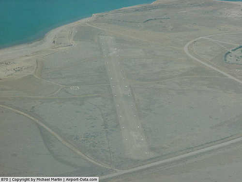
Runway 12/30
| Dimension: | 2550 x 90 ft / 777.2 x 27.4 m |
| Surface: | TURF, Fair Condition |
| |
Runway 12 |
Runway 30 |
| Traffic Pattern: | Left | Left |
| Obstruction: | , 50:1 slope to clear | 14 ft road, 171.0 ft from runway, 12:1 slope to clear |
|
Radio Navigation Aids
| ID |
Type |
Name |
Ch |
Freq |
Var |
Dist |
| LTY | NDB | Chester | | 323.00 | 15E | 12.7 nm |
| SBX | NDB | Shelby | | 347.00 | 18E | 33.0 nm |
| CRD | NDB | Conrad | | 293.00 | 17E | 33.1 nm |
| GFA | TACAN | Malmstrom | 105X | | 17E | 48.8 nm |
Remarks
- NO SNOW REMOVAL.
- RY 12/30 MAY BE ROUGH.
- VFR USE ONLY.
Images and information placed above are from
http://www.airport-data.com/airport/B70/
We thank them for the data!
| General Info
|
| Country |
United States
|
| State |
MONTANA
|
| FAA ID |
B70
|
| Latitude |
48-18-49.935N
|
| Longitude |
111-06-32.908W
|
| Elevation |
3023 feet
|
| Near City |
TIBER DAM
|
We don't guarantee the information is fresh and accurate. The data may
be wrong or outdated.
For more up-to-date information please refer to other sources.
|
|


