 |
|
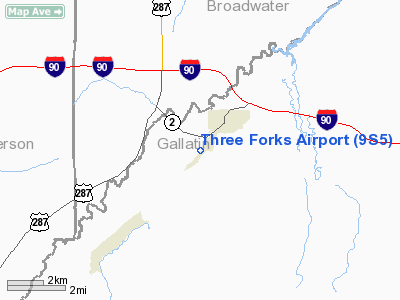
Location & QuickFacts
| FAA Information Effective: | 2008-09-25 |
| Airport Identifier: | 9S5 |
| Airport Status: | Operational |
| Longitude/Latitude: | 111-34-09.9550W/45-52-41.2100N
-111.569432/45.878114 (Estimated) |
| Elevation: | 4089 ft / 1246.33 m (Surveyed) |
| Land: | 160 acres |
| From nearest city: | 1 nautical miles SE of Three Forks, MT |
| Location: | Gallatin County, MT |
| Magnetic Variation: | 16E (1985) |
Owner & Manager
| Ownership: | Publicly owned |
| Owner: | Gallatin County |
| Address: | 311 West Main
Three Forks, MT 59792 |
| Phone number: | 406-585-1400 |
| Manager: | Ken Allen |
| Address: | 130 Airport Rd
Three Forks, MT 59752 |
| Phone number: | 406-285-3140
CALL BILL FAIRHURST AT 406-285-3515 IF NO ANSWER AT AMGR NUMBER. |
Airport Operations and Facilities
| Airport Use: | Open to public |
| Wind indicator: | Yes |
| Segmented Circle: | Yes |
| Control Tower: | No |
| Lighting Schedule: | RDO-CTL
ACTVT MIRL RY 02/20; PAPI RYS 02 & 20 & ROTG BCN - CTAF. |
| Beacon Color: | Clear-Green (lighted land airport) |
| Landing fee charge: | No |
| Sectional chart: | Great Falls |
| Region: | ANM - Northwest Mountain |
| Boundary ARTCC: | ZLC - Salt Lake City |
| Tie-in FSS: | GTF - Great Falls |
| FSS on Airport: | No |
| FSS Toll Free: | 1-800-WX-BRIEF |
| NOTAMs Facility: | GTF (NOTAM-d service avaliable) |
| Federal Agreements: | NGY |
Airport Communications
| CTAF: | 122.800 |
| Unicom: | 122.800 |
Airport Services
| Fuel available: | 100LL
FUEL 24 HR CREDIT CARD SVC AVBL. |
| Airframe Repair: | MAJOR |
| Power Plant Repair: | MAJOR |
| Bottled Oxygen: | NONE |
| Bulk Oxygen: | NONE |
Runway Information
Runway 02/20
| Dimension: | 5100 x 60 ft / 1554.5 x 18.3 m |
| Surface: | ASPH, Good Condition |
| Weight Limit: | Single wheel: 12000 lbs. |
| Edge Lights: | Medium |
| |
Runway 02 |
Runway 20 |
| Longitude: | 111-34-33.0900W | 111-33-46.8200W |
| Latitude: | 45-52-21.9200N | 45-53-00.5000N |
| Elevation: | 4089.00 ft | 4081.00 ft |
| Traffic Pattern: | Left | Left |
| Markings: | Basic, Good Condition | Basic, Good Condition |
| Crossing Height: | 24.00 ft | 25.00 ft |
| VASI: | 2-light PAPI on left side | 2-light PAPI on left side |
| Visual Glide Angle: | 3.00° | 3.00° |
|
Radio Navigation Aids
| ID |
Type |
Name |
Ch |
Freq |
Var |
Dist |
| EKS | NDB | Ennis | | 286.00 | 15E | 37.0 nm |
| HAU | NDB | Hauser | | 386.00 | 16E | 42.3 nm |
| CVP | NDB | Capitol | | 335.00 | 16E | 46.4 nm |
| BZN | VOR/DME | Bozeman | 071X | 112.40 | 18E | 18.2 nm |
| HIA | VORTAC | Whitehall | 084X | 113.70 | 18E | 25.1 nm |
| HLN | VORTAC | Helena | 124X | 117.70 | 16E | 46.6 nm |
| LVM | VORTAC | Livingston | 108X | 116.10 | 15E | 48.4 nm |
Remarks
- DEER ON & IN VICINITY OF ARPT.
- OCCASIONAL AEROBATIC MANEUVERS INVOF ARPT.
- ARPT ESTAB PRIOR TO 1959.
Images and information placed above are from
http://www.airport-data.com/airport/9S5/
We thank them for the data!
| General Info
|
| Country |
United States
|
| State |
MONTANA
|
| FAA ID |
9S5
|
| Latitude |
45-52-42.700N
|
| Longitude |
111-34-08.900W
|
| Elevation |
4086 feet
|
| Near City |
THREE FORKS
|
We don't guarantee the information is fresh and accurate. The data may
be wrong or outdated.
For more up-to-date information please refer to other sources.
|
|


