 |
|
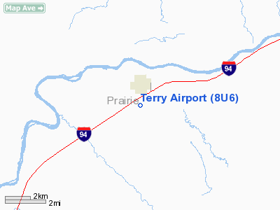
Location & QuickFacts
| FAA Information Effective: | 2008-09-25 |
| Airport Identifier: | 8U6 |
| Airport Status: | Operational |
| Longitude/Latitude: | 105-18-47.2000W/46-46-37.7000N
-105.313111/46.777139 (Estimated) |
| Elevation: | 2283 ft / 695.86 m (Surveyed) |
| Land: | 95 acres |
| From nearest city: | 1 nautical miles SE of Terry, MT |
| Location: | Prairie County, MT |
| Magnetic Variation: | 13E (1985) |
Owner & Manager
| Ownership: | Publicly owned |
| Owner: | Prairie County |
| Address: | P O Box 125
Terry, MT 59349 |
| Phone number: | 406-637-5575 |
| Manager: | Willis Bartholomay |
| Address: | Box 385
Terry, MT 59349 |
| Phone number: | 406-637-5459 |
Airport Operations and Facilities
| Airport Use: | Open to public |
| Wind indicator: | Yes |
| Segmented Circle: | Yes |
| Control Tower: | No |
| Lighting Schedule: | RDO-CTL
ACTVT MIRL RY 08/26 & ROTG BCN - CTAF. |
| Beacon Color: | Clear-Green (lighted land airport) |
| Landing fee charge: | No |
| Sectional chart: | Billings |
| Region: | ANM - Northwest Mountain |
| Boundary ARTCC: | ZLC - Salt Lake City |
| Tie-in FSS: | GTF - Great Falls |
| FSS on Airport: | No |
| FSS Toll Free: | 1-800-WX-BRIEF |
| NOTAMs Facility: | GTF (NOTAM-d service avaliable) |
| Federal Agreements: | NGY |
Airport Communications
Airport Services
| Airframe Repair: | NONE |
| Power Plant Repair: | NONE |
| Bottled Oxygen: | NONE |
| Bulk Oxygen: | NONE |
Runway Information
Runway 08/26
| Dimension: | 4300 x 75 ft / 1310.6 x 22.9 m |
| Surface: | ASPH, Good Condition |
| Weight Limit: | Single wheel: 12500 lbs. |
| Edge Lights: | Medium |
| |
Runway 08 |
Runway 26 |
| Longitude: | 105-19-18.1000W | 105-18-16.3000W |
| Latitude: | 46-46-38.0000N | 46-46-37.4000N |
| Elevation: | 2281.00 ft | 2283.00 ft |
| Alignment: | 91 | 127 |
| Traffic Pattern: | Left | Left |
| Markings: | Basic, Good Condition | Basic, Good Condition |
| Crossing Height: | 36.00 ft | 25.00 ft |
| VASI: | 2-light PAPI on left side | 2-light PAPI on left side |
| Visual Glide Angle: | 4.00° | 3.00° |
| Obstruction: | 4 ft fence, 240.0 ft from runway, 10:1 slope to clear | 15 ft road, 556.0 ft from runway, 23:1 slope to clear |
|
Radio Navigation Aids
| ID |
Type |
Name |
Ch |
Freq |
Var |
Dist |
| GDV | NDB | Glendive | | 410.00 | 13E | 29.9 nm |
| HTN | NDB | Horton | | 320.00 | 15E | 33.9 nm |
| CRR | NDB | Circle | | 245.00 | 15E | 39.8 nm |
| MLS | VORTAC | Miles City | 058X | 112.10 | 15E | 35.5 nm |
Remarks
- PAY PHONE ON FIELD.
- SNOW REMOVAL INTERMITTENT.
- ARPT CLSD 1800-0700.
- EXISTED PRIOR TO 1959.
Images and information placed above are from
http://www.airport-data.com/airport/8U6/
We thank them for the data!
| General Info
|
| Country |
United States
|
| State |
MONTANA
|
| FAA ID |
8U6
|
| Latitude |
46-46-45.024N
|
| Longitude |
105-18-16.950W
|
| Elevation |
2260 feet
|
| Near City |
TERRY
|
We don't guarantee the information is fresh and accurate. The data may
be wrong or outdated.
For more up-to-date information please refer to other sources.
|
|


