 |
|
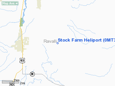
Location & QuickFacts
| FAA Information Effective: | 2008-09-25 |
| Airport Identifier: | 0MT3 |
| Airport Status: | Operational |
| Longitude/Latitude: | 114-04-03.0000W/46-15-03.0000N
-114.067500/46.250833 (Estimated) |
| Elevation: | 3920 ft / 1194.82 m (Estimated) |
| Land: | 2 acres |
| From nearest city: | 4 nautical miles E of Hamilton, MT |
| Location: | Ravalli County, MT |
| Magnetic Variation: | 17E (1995) |
Owner & Manager
| Ownership: | Privately owned |
| Owner: | Stock Farm |
| Address: | 1883 South Us Hwy 93
Hamilton, MT 59840 |
| Manager: | James R Schueler |
| Address: | Po Box 1888
Hamilton, MT 59840 |
| Phone number: | 406-375-1888 |
Airport Operations and Facilities
| Airport Use: | Private |
| Segmented Circle: | No |
| Control Tower: | No |
| Sectional chart: | Great Falls |
| Region: | ANM - Northwest Mountain |
| Boundary ARTCC: | ZLC - Salt Lake City |
| Tie-in FSS: | GTF - Great Falls |
| FSS on Airport: | No |
| FSS Toll Free: | 1-800-WX-BRIEF |
Runway Information
Helipad H1
| Dimension: | 40 x 40 ft / 12.2 x 12.2 m |
| Surface: | TURF, |
| |
Runway H1 |
Runway |
| Traffic Pattern: | Left | Left |
|
Radio Navigation Aids
| ID |
Type |
Name |
Ch |
Freq |
Var |
Dist |
| HMM | NDB | Hamilton | | 410.00 | 19E | 2.8 nm |
| DRU | VOR | Drummond | | 117.10 | 17E | 43.2 nm |
| MSO | VOR/DME | Missoula | 075X | 112.80 | 17E | 39.5 nm |
Remarks
- PRVDD DAYTIME VFR OPNS ONLY.
Images and information placed above are from
http://www.airport-data.com/airport/0MT3/
We thank them for the data!
| General Info
|
| Country |
United States
|
| State |
MONTANA
|
| FAA ID |
0MT3
|
| Latitude |
46-15-03.000N
|
| Longitude |
114-04-03.000W
|
| Elevation |
3920 feet
|
| Near City |
HAMILTON
|
We don't guarantee the information is fresh and accurate. The data may
be wrong or outdated.
For more up-to-date information please refer to other sources.
|
|


