 |
|
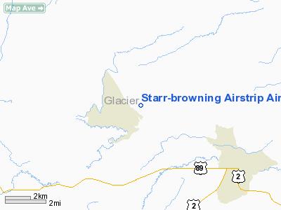
Starr-browning Airstrip Airport |
Location & QuickFacts
| FAA Information Effective: | 2008-09-25 |
| Airport Identifier: | 8S0 |
| Airport Status: | Operational |
| Longitude/Latitude: | 113-06-53.3270W/48-36-04.9040N
-113.114813/48.601362 (Estimated) |
| Elevation: | 4655 ft / 1418.84 m (Surveyed) |
| Land: | 28 acres |
| From nearest city: | 5 nautical miles NW of Browning, MT |
| Location: | Glacier County, MT |
| Magnetic Variation: | 18E (1985) |
Owner & Manager
| Ownership: | Publicly owned |
| Owner: | Mt Aero Div |
| Address: | Po Box 5178
Helena, MT 59604 |
| Phone number: | 406-444-2506 |
| Manager: | Mt Aero Div |
| Address: | Po Box 5178
Helena, MT 59604 |
| Phone number: | 406-444-2506 |
Airport Operations and Facilities
| Airport Use: | Open to public |
| Wind indicator: | Yes |
| Segmented Circle: | No |
| Control Tower: | No |
| Lighting Schedule: | DUSK-DAWN
ACTVT MIRL RY 06/24 - CTAF. |
| Beacon Color: | Clear-Green (lighted land airport) |
| Landing fee charge: | No |
| Sectional chart: | Great Falls |
| Region: | ANM - Northwest Mountain |
| Boundary ARTCC: | ZLC - Salt Lake City |
| Tie-in FSS: | GTF - Great Falls |
| FSS on Airport: | No |
| FSS Toll Free: | 1-800-WX-BRIEF |
| NOTAMs Facility: | GTF (NOTAM-d service avaliable) |
Airport Communications
Airport Services
| Airframe Repair: | NONE |
| Power Plant Repair: | NONE |
| Bottled Oxygen: | NONE |
| Bulk Oxygen: | NONE |
Runway Information
Runway 06/24
| Dimension: | 4069 x 74 ft / 1240.2 x 22.6 m |
| Surface: | ASPH, Fair Condition
TWY HAS DEBRIS & GRAVEL, WEEDS ENCROACHING |
| Edge Lights: | Medium |
| |
Runway 06 |
Runway 24 |
| Traffic Pattern: | Left | Left |
| Markings: | Basic, Fair Condition | Basic, Fair Condition |
| Obstruction: | 14 ft road, 553.0 ft from runway, 25:1 slope to clear
+4 FT FENCE 83 FT FM RY END, AND +10' ROAD 132' FM RY END XING RY CL OB. | , 50:1 slope to clear |
|
Radio Navigation Aids
| ID |
Type |
Name |
Ch |
Freq |
Var |
Dist |
| SBX | NDB | Shelby | | 347.00 | 18E | 49.9 nm |
| FCA | VOR/DME | Kalispell | 079X | 113.20 | 18E | 48.3 nm |
| CTB | VORTAC | Cut Bank | 091X | 114.40 | 17E | 30.8 nm |
Remarks
- NO SNOW REMOVAL.
- LIVESTOCK ON & INVOF ARPT.
- PHONE AVBL AT BROWNING SCHOOL.
Images and information placed above are from
http://www.airport-data.com/airport/8S0/
We thank them for the data!
| General Info
|
| Country |
United States
|
| State |
MONTANA
|
| FAA ID |
8S0
|
| Latitude |
48-36-04.904N
|
| Longitude |
113-06-53.327W
|
| Elevation |
4655 feet
|
| Near City |
BROWNING
|
We don't guarantee the information is fresh and accurate. The data may
be wrong or outdated.
For more up-to-date information please refer to other sources.
|
|


