 |
|
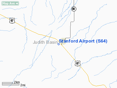
Location & QuickFacts
| FAA Information Effective: | 2008-09-25 |
| Airport Identifier: | S64 |
| Airport Status: | Operational |
| Longitude/Latitude: | 110-13-47.1500W/47-08-48.1900N
-110.229764/47.146719 (Estimated) |
| Elevation: | 4327 ft / 1318.87 m (Estimated) |
| Land: | 133 acres |
| From nearest city: | 1 nautical miles S of Stanford, MT |
| Location: | Judith Basin County, MT |
| Magnetic Variation: | 16E (1985) |
Owner & Manager
| Ownership: | Publicly owned |
| Owner: | Judith Basin County |
| Address: | County Courthouse
Stanford, MT 59479 |
| Phone number: | 406-566-2291 |
| Manager: | Mike Biggerstaff |
| Address: | Po Box 340
Stanford, MT 59479 |
| Phone number: | 406-566-2236 |
Airport Operations and Facilities
| Airport Use: | Open to public |
| Wind indicator: | Yes |
| Segmented Circle: | Yes |
| Control Tower: | No |
| Lighting Schedule: | DUSK-DAWN
ACTVT MIRL RY 11/29 AND PAPI RY 29 - CTAF. |
| Beacon Color: | Clear-Green (lighted land airport) |
| Landing fee charge: | No |
| Sectional chart: | Great Falls |
| Region: | ANM - Northwest Mountain |
| Boundary ARTCC: | ZLC - Salt Lake City |
| Tie-in FSS: | GTF - Great Falls |
| FSS on Airport: | No |
| FSS Toll Free: | 1-800-WX-BRIEF |
| NOTAMs Facility: | GTF (NOTAM-d service avaliable) |
| Federal Agreements: | NGY |
Airport Communications
| CTAF: | 122.800 |
| Unicom: | 122.800 |
Airport Services
| Fuel available: | 100LLMOGAS
MOGAS AVBL FM STATION ATTENDANT ACROSS FM HGRS. |
| Airframe Repair: | NONE |
| Power Plant Repair: | NONE |
| Bottled Oxygen: | NONE |
| Bulk Oxygen: | NONE |
Runway Information
Runway 07/25
| Dimension: | 1960 x 100 ft / 597.4 x 30.5 m |
| Surface: | ASPH-GRVL, Fair Condition
FIRST 265 FT OF RWY 25 PAVED. NEXT 200 FT GRAVEL WITH TALL GRASS/WEED CLUSTERS GROWING THROUGH. FIRST 500 FT RWY 07 VERY ROUGH; MULTIPLE GOPHER HOLES. |
| |
Runway 07 |
Runway 25 |
| Longitude: | 110-13-55.1100W | 110-13-26.7200W |
| Latitude: | 47-08-39.6700N | 47-08-39.6700N |
| Elevation: | 4365.00 ft | 4314.00 ft |
| Traffic Pattern: | Left | Left |
| Obstruction: | 9 ft fence, 313.0 ft from runway, 37:1 slope to clear | 25 ft pline, 433.0 ft from runway, 18:1 slope to clear |
|
Runway 11/29
| Dimension: | 4200 x 75 ft / 1280.2 x 22.9 m |
| Surface: | ASPH, Good Condition
FIRST 265 FT OF RWY 25 PAVED. NEXT 200 FT GRAVEL WITH TALL GRASS/WEED CLUSTERS GROWING THROUGH. FIRST 500 FT RWY 07 VERY ROUGH; MULTIPLE GOPHER HOLES. |
| Weight Limit: | Single wheel: 12000 lbs. |
| Edge Lights: | Medium |
| |
Runway 11 |
Runway 29 |
| Longitude: | 110-14-14.4300W | 110-13-25.8500W |
| Latitude: | 47-09-04.5600N | 47-08-39.6700N |
| Elevation: | 4324.00 ft | 4313.00 ft |
| Traffic Pattern: | Left | Left |
| Markings: | Basic, Poor Condition
RWY MARKINGS FADED | Basic, Poor Condition
RWY MARKINGS FADED |
| Crossing Height: | 0.00 ft | 30.00 ft |
| VASI: | | 2-light PAPI on left side |
| Visual Glide Angle: | 0.00° | 3.00° |
| Obstruction: | 6 ft fence, 299.0 ft from runway, 17:1 slope to clear | 13 ft road, 532.0 ft from runway, 160L/ ft right of centerline, 31:1 slope to clear |
|
Radio Navigation Aids
| ID |
Type |
Name |
Ch |
Freq |
Var |
Dist |
| LWT | NDB | Lewistown | | 353.00 | 17E | 28.8 nm |
| HWQ | NDB | Harlowton | | 242.00 | 17E | 45.8 nm |
| ITU | NDB | Truly | | 371.00 | 16E | 48.5 nm |
| GFA | TACAN | Malmstrom | 105X | | 17E | 44.3 nm |
| LWT | VORTAC | Lewistown | 057X | 112.00 | 15E | 26.1 nm |
Remarks
Images and information placed above are from
http://www.airport-data.com/airport/S64/
We thank them for the data!
| General Info
|
| Country |
United States
|
| State |
MONTANA
|
| FAA ID |
S64
|
| Latitude |
47-08-49.882N
|
| Longitude |
110-13-47.744W
|
| Elevation |
4329 feet
|
| Near City |
STANFORD
|
We don't guarantee the information is fresh and accurate. The data may
be wrong or outdated.
For more up-to-date information please refer to other sources.
|
|


