 |
|
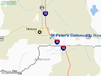
St Peter's Community Hospital Heliport |
Location & QuickFacts
| FAA Information Effective: | 2008-09-25 |
| Airport Identifier: | MT35 |
| Airport Status: | Operational |
| Longitude/Latitude: | 111-59-47.9810W/46-35-04.7630N
-111.996661/46.584656 (Estimated) |
| Elevation: | 4115 ft / 1254.25 m (Estimated) |
| Land: | 0 acres |
| From nearest city: | 1 nautical miles NW of Helena, MT |
| Location: | Lewis And Clark County, MT |
| Magnetic Variation: | 17E (1985) |
Owner & Manager
| Ownership: | Privately owned |
| Owner: | St Peter's Community Hospital |
| Address: | 2475 Broadway
Helena, MT 59601 |
| Phone number: | 406-442-2480 |
| Manager: | St Peter's Community Hospital |
| Address: | 2475 Broadway
Helena, MT 59601 |
| Phone number: | 406-442-2480 |
Airport Operations and Facilities
| Airport Use: | Private
MEDICAL USE. |
| Wind indicator: | Yes |
| Segmented Circle: | No |
| Control Tower: | No |
| Landing fee charge: | No |
| Sectional chart: | Great Falls |
| Region: | ANM - Northwest Mountain |
| Boundary ARTCC: | ZLC - Salt Lake City |
| Tie-in FSS: | GTF - Great Falls |
| FSS on Airport: | No |
| FSS Toll Free: | 1-800-WX-BRIEF |
Runway Information
Helipad H1
| Dimension: | 40 x 40 ft / 12.2 x 12.2 m |
| Surface: | CONC, |
| |
Runway H1 |
Runway |
| Traffic Pattern: | Left | Left |
|
Radio Navigation Aids
| ID |
Type |
Name |
Ch |
Freq |
Var |
Dist |
| CVP | NDB | Capitol | | 335.00 | 16E | 2.8 nm |
| HAU | NDB | Hauser | | 386.00 | 16E | 9.9 nm |
| DRU | VOR | Drummond | | 117.10 | 17E | 49.2 nm |
| CPN | VOR/DME | Coppertown | 053X | 111.60 | 16E | 45.6 nm |
| HLN | VORTAC | Helena | 124X | 117.70 | 16E | 2.2 nm |
| HIA | VORTAC | Whitehall | 084X | 113.70 | 18E | 44.0 nm |
Remarks
- PROVIDED INGRESS/EGRESS ROUTES ARE TO AND FROM THE SOUTH AND PILOTS CONTACT THE HELENA ATCT FOR TRAFFIC ADVISORIES WHILE OPERATING IN THE HELENA CONTROL ZONE.
Images and information placed above are from
http://www.airport-data.com/airport/MT35/
We thank them for the data!
| General Info
|
| Country |
United States
|
| State |
MONTANA
|
| FAA ID |
MT35
|
| Latitude |
46-35-04.763N
|
| Longitude |
111-59-47.981W
|
| Elevation |
4115 feet
|
| Near City |
HELENA
|
We don't guarantee the information is fresh and accurate. The data may
be wrong or outdated.
For more up-to-date information please refer to other sources.
|
|


