 |
|
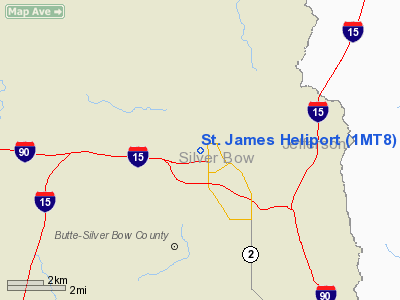
Location & QuickFacts
| FAA Information Effective: | 2008-09-25 |
| Airport Identifier: | 1MT8 |
| Airport Status: | Operational |
| Longitude/Latitude: | 112-32-40.7000W/46-00-33.7000N
-112.544639/46.009361 (Estimated) |
| Elevation: | 5733 ft / 1747.42 m (Estimated) |
| Land: | 1 acres |
| From nearest city: | 1 nautical miles NE of Butte, MT |
| Location: | Silver Bow County, MT |
| Magnetic Variation: | () |
Owner & Manager
| Ownership: | Privately owned |
| Owner: | St. James Healthcare |
| Address: | 400 S. Clark
Butte, MT 59701 |
| Phone number: | 406-723-2500 |
| Manager: | Dave Fawcett |
| Address: | 400 S. Clark
Butte, MT 59701 |
| Phone number: | 406-723-2500 |
Airport Operations and Facilities
| Airport Use: | Private |
| Wind indicator: | Yes |
| Control Tower: | No |
| Lighting Schedule: | PHONE-REQ |
| Sectional chart: | Salt Lake City |
| Region: | ANM - Northwest Mountain |
| Boundary ARTCC: | ZLC - Salt Lake City |
| Tie-in FSS: | GTF - Great Falls |
| FSS Toll Free: | 1-800-WX-BRIEF |
Runway Information
Helipad H1
| Dimension: | 45 x 45 ft / 13.7 x 13.7 m |
| Surface: | CONC, |
| |
Runway H1 |
Runway |
| Traffic Pattern: | Left | Left |
| Markings: | Basic, | , |
|
Radio Navigation Aids
| ID |
Type |
Name |
Ch |
Freq |
Var |
Dist |
| CVP | NDB | Capitol | | 335.00 | 16E | 43.9 nm |
| HAU | NDB | Hauser | | 386.00 | 16E | 46.9 nm |
| DRU | VOR | Drummond | | 117.10 | 17E | 46.1 nm |
| CPN | VOR/DME | Coppertown | 053X | 111.60 | 16E | 8.6 nm |
| DLN | VOR/DME | Dillon | 077X | 113.00 | 18E | 45.7 nm |
| HIA | VORTAC | Whitehall | 084X | 113.70 | 18E | 18.0 nm |
| HLN | VORTAC | Helena | 124X | 117.70 | 16E | 43.5 nm |
Remarks
- MEDICAL USE.
- HOSP BLDG 105 FT FROM HELIPAD.
- PRVDD VFR OPNS ONLY.
Images and information placed above are from
http://www.airport-data.com/airport/1MT8/
We thank them for the data!
We don't guarantee the information is fresh and accurate. The data may
be wrong or outdated.
For more up-to-date information please refer to other sources.
|
|


