 |
|
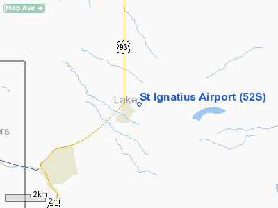
Location & QuickFacts
| FAA Information Effective: | 2008-09-25 |
| Airport Identifier: | 52S |
| Airport Status: | Operational |
| Longitude/Latitude: | 114-04-50.3890W/47-19-29.7500N
-114.080664/47.324931 (Estimated) |
| Elevation: | 3006 ft / 916.23 m (Surveyed) |
| Land: | 80 acres |
| From nearest city: | 1 nautical miles NE of St Ignatius, MT |
| Location: | Lake County, MT |
| Magnetic Variation: | 18E (1985) |
Owner & Manager
| Ownership: | Publicly owned |
| Owner: | St Ignatius City |
| Address: | City Hall
St Ignatius, MT 59865 |
| Phone number: | 406-745-3791 |
| Manager: | Gail Anderson |
| Address: | 900 Airport Rd
St Ignatius, MT 59865 |
| Phone number: | 406-745-4008 |
Airport Operations and Facilities
| Airport Use: | Open to public |
| Wind indicator: | Yes |
| Segmented Circle: | No |
| Control Tower: | No |
| Lighting Schedule: | DUSK-DAWN
ACTVT LIRL RWY 08/26 - 122.9. |
| Beacon Color: | Clear-Green (lighted land airport) |
| Landing fee charge: | No |
| Sectional chart: | Great Falls |
| Region: | ANM - Northwest Mountain |
| Boundary ARTCC: | ZLC - Salt Lake City |
| Tie-in FSS: | GTF - Great Falls |
| FSS on Airport: | No |
| FSS Toll Free: | 1-800-WX-BRIEF |
| NOTAMs Facility: | GTF (NOTAM-d service avaliable) |
Airport Communications
Airport Services
| Fuel available: | 100LL |
| Airframe Repair: | MINOR |
| Power Plant Repair: | MINOR |
| Bottled Oxygen: | NONE |
| Bulk Oxygen: | NONE |
Runway Information
Runway 08/26
| Dimension: | 2610 x 60 ft / 795.5 x 18.3 m |
| Surface: | ASPH, Good Condition |
| Edge Lights: | Low
90 FT UNLIGHTED; RY 26 243 FT UNLIGHTED; 2277 FT LIGHTED AT NIGHT. |
| |
Runway 08 |
Runway 26 |
| Traffic Pattern: | Left | Left |
| Markings: | Basic, Fair Condition
MARKINGS NONSTD | Basic, Fair Condition |
| Obstruction: | 15 ft road, 200.0 ft from runway, 125 ft left of centerline
WINDSOCK AND HANGARS IN TRANSITIONAL SURFACES | 18 ft bldg, 385.0 ft from runway, 141 ft left of centerline, 10:1 slope to clear
RWY 26 +15' RD 302' FM EOR 0B, +4' FENCE 281' FM EOR 0B |
|
Radio Navigation Aids
| ID |
Type |
Name |
Ch |
Freq |
Var |
Dist |
| INE | NDB | Konna | | 521.00 | 17E | 18.9 nm |
| PLS | NDB | Polson | | 275.00 | 20E | 22.7 nm |
| SAK | NDB | Smith Lake | | 515.00 | 18E | 49.5 nm |
| MSO | VOR/DME | Missoula | 075X | 112.80 | 17E | 25.1 nm |
Remarks
- SNOW REMOVAL.
- TELEPHONE ON FIELD 406-745-4008.
- MIGRATORY FLOCKS OF BIRDS INVOF RY.
- EXISTED PRIOR TO 1959.
Images and information placed above are from
http://www.airport-data.com/airport/52S/
We thank them for the data!
| General Info
|
| Country |
United States
|
| State |
MONTANA
|
| FAA ID |
52S
|
| Latitude |
47-19-29.750N
|
| Longitude |
114-04-50.389W
|
| Elevation |
3006 feet
|
| Near City |
ST IGNATIUS
|
We don't guarantee the information is fresh and accurate. The data may
be wrong or outdated.
For more up-to-date information please refer to other sources.
|
|


