 |
|
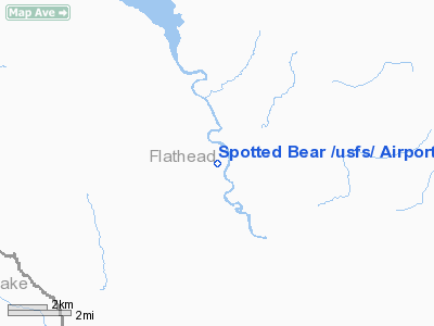
Spotted Bear /usfs/ Airport |
Location & QuickFacts
| FAA Information Effective: | 2008-09-25 |
| Airport Identifier: | 8U4 |
| Airport Status: | Operational |
| Longitude/Latitude: | 113-33-33.3200W/47-57-29.8110N
-113.559256/47.958281 (Estimated) |
| Elevation: | 3670 ft / 1118.62 m (Estimated) |
| Land: | 26 acres |
| From nearest city: | 3 nautical miles NW of Spotted Bear, MT |
| Location: | Flathead County, MT |
| Magnetic Variation: | 18E (1985) |
Owner & Manager
| Ownership: | Publicly owned |
| Owner: | Us Forest Service |
| Address: | Flathead National Forest
Kalispell, MT 59901 |
| Phone number: | 406-755-5401 |
| Manager: | Deb Mucklow, Dist Ranger |
| Address: | Spotted Bear Ranger Station
Hungry Horse, MT 59919 |
| Phone number: | 406-758-5376
SUMMER PHONE: 406-758-5376 |
Airport Operations and Facilities
| Airport Use: | Open to public |
| Wind indicator: | Yes |
| Segmented Circle: | No |
| Control Tower: | No |
| Landing fee charge: | No |
| Sectional chart: | Great Falls |
| Region: | ANM - Northwest Mountain |
| Boundary ARTCC: | ZLC - Salt Lake City |
| Tie-in FSS: | GTF - Great Falls |
| FSS on Airport: | No |
| FSS Toll Free: | 1-800-WX-BRIEF |
| NOTAMs Facility: | GTF (NOTAM-d service avaliable) |
Airport Communications
Airport Services
| Airframe Repair: | NONE |
| Power Plant Repair: | NONE |
| Bottled Oxygen: | NONE |
| Bulk Oxygen: | NONE |
Runway Information
Runway 14/32
| Dimension: | 3800 x 78 ft / 1158.2 x 23.8 m
N QUARTER OF STRIP HAS A SLIGHT DOG-LEG; DOG LEG BEGINS 1100 FT FM N END. |
| Surface: | TURF, Good Condition |
| |
Runway 14 |
Runway 32 |
| Traffic Pattern: | Left | Left |
| Markings: | , | Nonstandard,
RWY 32 NSTD MKGS FIRST 2400 FT MKD WITH CONES SPACED 200 FT APART INCLUDING DOGLEG. |
| Obstruction: | 60 ft trees, 600.0 ft from runway, 10:1 slope to clear | 35 ft trees, 427.0 ft from runway, 12:1 slope to clear |
|
Radio Navigation Aids
| ID |
Type |
Name |
Ch |
Freq |
Var |
Dist |
| PLS | NDB | Polson | | 275.00 | 20E | 29.9 nm |
| SAK | NDB | Smith Lake | | 515.00 | 18E | 37.4 nm |
| FCA | VOR/DME | Kalispell | 079X | 113.20 | 18E | 29.1 nm |
Remarks
- MTNS & TREES IN TRNSTN AREA TO E & W.
- PHONE IN RANGER STATION.
- EST PRIOR TO 1959.
Images and information placed above are from
http://www.airport-data.com/airport/8U4/
We thank them for the data!
| General Info
|
| Country |
United States
|
| State |
MONTANA
|
| FAA ID |
8U4
|
| Latitude |
47-57-29.811N
|
| Longitude |
113-33-33.320W
|
| Elevation |
3670 feet
|
| Near City |
SPOTTED BEAR
|
We don't guarantee the information is fresh and accurate. The data may
be wrong or outdated.
For more up-to-date information please refer to other sources.
|
|


