 |
|
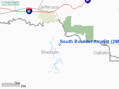
Location & QuickFacts
| FAA Information Effective: | 2008-09-25 |
| Airport Identifier: | 2MT8 |
| Airport Status: | Operational |
| Longitude/Latitude: | 111-55-33.2400W/45-48-54.3600N
-111.925900/45.815100 (Estimated) |
| Elevation: | 4560 ft / 1389.89 m (Estimated) |
| Land: | 4 acres |
| From nearest city: | 4 nautical miles S of Cardwell, MT |
| Location: | Madison County, MT |
| Magnetic Variation: | () |
Owner & Manager
| Ownership: | Privately owned |
| Owner: | Jean E. Deming |
| Address: | 463 Hwy 359
Cardwell, MT 59721 |
| Phone number: | 406-287-5799 |
| Manager: | Jean E. Deming |
| Address: | 463 Hwy 359
Cardwell, MT 59721 |
| Phone number: | 406-287-5799 |
Airport Operations and Facilities
| Airport Use: | Private |
| Wind indicator: | Yes |
| Control Tower: | No |
| Sectional chart: | Great Falls |
| Region: | ANM - Northwest Mountain |
| Boundary ARTCC: | ZKC - Kansas City |
| Tie-in FSS: | COU - Columbia |
| FSS Toll Free: | 1-800-WX-BRIEF |
Runway Information
Runway 18/36
| Dimension: | 3000 x 100 ft / 914.4 x 30.5 m |
| Surface: | TURF, |
| |
Runway 18 |
Runway 36 |
| Traffic Pattern: | Right | Left |
| Obstruction: | 10 ft fence, 5.0 ft from runway | 100 ft tree, 150.0 ft from runway |
|
Radio Navigation Aids
| ID |
Type |
Name |
Ch |
Freq |
Var |
Dist |
| EKS | NDB | Ennis | | 286.00 | 15E | 35.0 nm |
| HAU | NDB | Hauser | | 386.00 | 16E | 45.8 nm |
| CVP | NDB | Capitol | | 335.00 | 16E | 47.6 nm |
| BZN | VOR/DME | Bozeman | 071X | 112.40 | 18E | 32.3 nm |
| CPN | VOR/DME | Coppertown | 053X | 111.60 | 16E | 36.7 nm |
| DLN | VOR/DME | Dillon | 077X | 113.00 | 18E | 42.9 nm |
| HIA | VORTAC | Whitehall | 084X | 113.70 | 18E | 10.6 nm |
| HLN | VORTAC | Helena | 124X | 117.70 | 16E | 47.6 nm |
Remarks
Images and information placed above are from
http://www.airport-data.com/airport/2MT8/
We thank them for the data!
We don't guarantee the information is fresh and accurate. The data may
be wrong or outdated.
For more up-to-date information please refer to other sources.
|
|


