 |
|
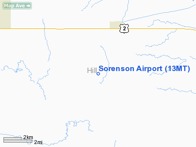
Location & QuickFacts
| FAA Information Effective: | 2008-09-25 |
| Airport Identifier: | 13MT |
| Airport Status: | Operational |
| Longitude/Latitude: | 110-06-47.7600W/48-31-14.9730N
-110.113267/48.520826 (Estimated) |
| Elevation: | 2873 ft / 875.69 m (Estimated) |
| Land: | 0 acres |
| From nearest city: | 3 nautical miles SW of Kremlin, MT |
| Location: | Hill County, MT |
| Magnetic Variation: | 16E (1985) |
Owner & Manager
| Ownership: | Privately owned |
| Owner: | Arnold Sorenson |
| Address: | Po Box 29
Kremlin, MT 59532 |
| Phone number: | 406-372-3260 |
| Manager: | Arnold Sorenson |
| Address: | Po Box 29
Kremlin, MT 59532 |
| Phone number: | 406-372-3260 |
Airport Operations and Facilities
| Airport Use: | Private |
| Wind indicator: | Yes |
| Segmented Circle: | No |
| Control Tower: | No |
| Landing fee charge: | No |
| Sectional chart: | Great Falls |
| Region: | ANM - Northwest Mountain |
| Boundary ARTCC: | ZLC - Salt Lake City |
| Tie-in FSS: | GTF - Great Falls |
| FSS on Airport: | No |
| FSS Toll Free: | 1-800-WX-BRIEF |
Airport Services
| Airframe Repair: | NONE |
| Power Plant Repair: | NONE |
Runway Information
Runway E/W
| Dimension: | 2300 x 60 ft / 701.0 x 18.3 m |
| Surface: | TURF, |
| |
Runway E |
Runway W |
| Traffic Pattern: | Left | Left |
|
Radio Navigation Aids
| ID |
Type |
Name |
Ch |
Freq |
Var |
Dist |
| LDS | NDB | Leeds | | 389.00 | 16E | 16.9 nm |
| LTY | NDB | Chester | | 323.00 | 15E | 34.6 nm |
| HVR | VOR/DME | Havre | 055X | 111.80 | 16E | 13.7 nm |
Remarks
Images and information placed above are from
http://www.airport-data.com/airport/13MT/
We thank them for the data!
| General Info
|
| Country |
United States
|
| State |
MONTANA
|
| FAA ID |
13MT
|
| Latitude |
48-31-14.973N
|
| Longitude |
110-06-47.760W
|
| Elevation |
2873 feet
|
| Near City |
KREMLIN
|
We don't guarantee the information is fresh and accurate. The data may
be wrong or outdated.
For more up-to-date information please refer to other sources.
|
|


