 |
|
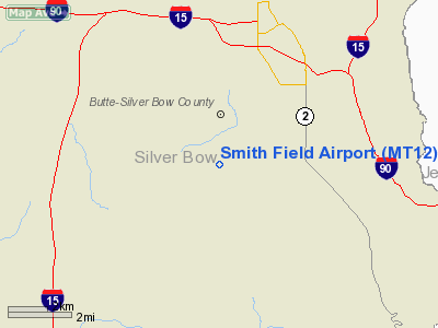
Location & QuickFacts
| FAA Information Effective: | 2008-09-25 |
| Airport Identifier: | MT12 |
| Airport Status: | Operational |
| Longitude/Latitude: | 112-33-51.0800W/45-56-18.7340N
-112.564189/45.938537 (Estimated) |
| Elevation: | 6000 ft / 1828.80 m (Estimated) |
| Land: | 0 acres |
| From nearest city: | 5 nautical miles SW of Butte, MT |
| Location: | Silver Bow County, MT |
| Magnetic Variation: | 17E (1985) |
Owner & Manager
| Ownership: | Privately owned |
| Owner: | Emmette T. Whalen |
| Address: | 451 Little Basin Creek
Butte, MT 59701 |
| Phone number: | 406-494-5214 |
| Manager: | W. J. Smith |
| Address: | 235 Little Basin Creek
Butte, MT 59701 |
Airport Operations and Facilities
| Airport Use: | Private |
| Wind indicator: | Yes |
| Segmented Circle: | No |
| Control Tower: | No |
| Landing fee charge: | No |
| Sectional chart: | Great Falls |
| Region: | ANM - Northwest Mountain |
| Boundary ARTCC: | ZLC - Salt Lake City |
| Tie-in FSS: | GTF - Great Falls |
| FSS on Airport: | No |
| FSS Toll Free: | 1-800-WX-BRIEF |
Runway Information
Runway 11/29
| Dimension: | 2300 x 50 ft / 701.0 x 15.2 m |
| Surface: | TURF, |
| |
Runway 11 |
Runway 29 |
| Traffic Pattern: | Left | Right |
|
Radio Navigation Aids
| ID |
Type |
Name |
Ch |
Freq |
Var |
Dist |
| CVP | NDB | Capitol | | 335.00 | 16E | 47.9 nm |
| DRU | VOR | Drummond | | 117.10 | 17E | 49.3 nm |
| CPN | VOR/DME | Coppertown | 053X | 111.60 | 16E | 9.5 nm |
| DLN | VOR/DME | Dillon | 077X | 113.00 | 18E | 41.5 nm |
| HIA | VORTAC | Whitehall | 084X | 113.70 | 18E | 17.1 nm |
| HLN | VORTAC | Helena | 124X | 117.70 | 16E | 47.5 nm |
Remarks
- VFR USE ONLY; PILOTS MAINTAIN CONTACT WITH BUTTE CTAF.
Images and information placed above are from
http://www.airport-data.com/airport/MT12/
We thank them for the data!
| General Info
|
| Country |
United States
|
| State |
MONTANA
|
| FAA ID |
MT12
|
| Latitude |
45-56-18.734N
|
| Longitude |
112-33-51.080W
|
| Elevation |
6000 feet
|
| Near City |
BUTTE
|
We don't guarantee the information is fresh and accurate. The data may
be wrong or outdated.
For more up-to-date information please refer to other sources.
|
|


