 |
|
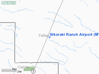
Location & QuickFacts
| FAA Information Effective: | 2008-09-25 |
| Airport Identifier: | MT74 |
| Airport Status: | Operational |
| Longitude/Latitude: | 104-24-54.8060W/46-06-25.0020N
-104.415224/46.106945 (Estimated) |
| Elevation: | 3330 ft / 1014.98 m (Estimated) |
| Land: | 20 acres |
| From nearest city: | 17 nautical miles NE of Ekalaka, MT |
| Location: | Fallon County, MT |
| Magnetic Variation: | 13E (1985) |
Owner & Manager
| Ownership: | Privately owned |
| Owner: | Sikorski & Sons |
| Address: | Box 202
Williard, MT 59354 |
| Phone number: | 406-775-6535 |
| Address: |
|
| Phone number: | 406-775-6241 |
Airport Operations and Facilities
| Airport Use: | Private |
| Wind indicator: | Yes |
| Segmented Circle: | No |
| Control Tower: | No |
| Sectional chart: | Billings |
| Region: | ANM - Northwest Mountain |
| Boundary ARTCC: | ZLC - Salt Lake City |
| Tie-in FSS: | GTF - Great Falls |
| FSS Toll Free: | 1-800-WX-BRIEF |
Runway Information
Runway 11/29
| Dimension: | 4000 x 30 ft / 1219.2 x 9.1 m |
| Surface: | TURF, |
| |
Runway 11 |
Runway 29 |
| Traffic Pattern: | Left | Left |
|
Radio Navigation Aids
| ID |
Type |
Name |
Ch |
Freq |
Var |
Dist |
| BKU | NDB | Timber | | 344.00 | 12E | 15.9 nm |
| BOD | NDB | Bowman | | 374.00 | 10E | 41.3 nm |
Images and information placed above are from
http://www.airport-data.com/airport/MT74/
We thank them for the data!
| General Info
|
| Country |
United States
|
| State |
MONTANA
|
| FAA ID |
MT74
|
| Latitude |
46-06-25.002N
|
| Longitude |
104-24-54.806W
|
| Elevation |
3330 feet
|
| Near City |
EKALAKA
|
We don't guarantee the information is fresh and accurate. The data may
be wrong or outdated.
For more up-to-date information please refer to other sources.
|
|


