 |
|
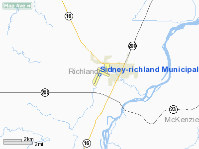
Sidney-richland Municipal Airport |
| Sidney-Richland Municipal Airport |
| IATA: SDY – ICAO: KSDY – FAA LID: SDY |
| Summary |
| Airport type |
Public |
| Owner |
Sidney Richland Airport Authority |
| Serves |
Sidney, Montana |
| Elevation AMSL |
1,985 ft / 605 m |
| Coordinates |
47°42′25″N 104°11′33″W / 47.70694°N 104.1925°W / 47.70694; -104.1925 |
| Runways |
| Direction |
Length |
Surface |
| ft |
m |
| 1/19 |
5,705 |
1,739 |
Asphalt |
| 10/28 |
4,023 |
1,226 |
Asphalt |
| Statistics (2006) |
| Aircraft operations |
24,050 |
| Source: Federal Aviation Administration |
Sidney-Richland Municipal Airport (IATA: SDY, ICAO: KSDY, FAA LID: SDY) is a public use airport located one nautical mile (1.85 km) west of the central business district of Sidney, a city in Richland County, Montana, United States. It is owned by the Sidney Richland Airport Authority. This airport is mostly used for general aviation, but is also designated to receive commercial service subsidized by the federal Essential Air Service (EAS) program.
Scheduled air service at Sidney ended on March 8, 2008, when Big Sky Airlines (the designated EAS operator) ceased operation. Great Lakes Airlines has been given USDOT approval to take over EAS service between Sidney and Denver, Colorado. Facilities and aircraft
Sidney-Richland Municipal Airport covers an area of 335 acres (136 ha) at an elevation of 1,985 feet (605 m) above mean sea level. It has two asphalt paved runways: 1/19 is 5,705 by 100 feet (1,739 x 30 m) and 10/28 is 4,023 by 100 feet (1,226 x 30 m). For the 12-month period ending December 31, 2006, the airport had 24,050 aircraft operations, an average of 65 per day: 82% general aviation, 18% air taxi, and <1% military.
Airlines and destinations
| Airlines |
Destinations |
| Great Lakes Airlines |
Billings, Denver, Dickinson, Gillette |
The above content comes from Wikipedia and is published under free licenses – click here to read more.
Location & QuickFacts
| FAA Information Effective: | 2008-09-25 |
| Airport Identifier: | SDY |
| Airport Status: | Operational |
| Longitude/Latitude: | 104-11-33.2000W/47-42-24.7000N
-104.192556/47.706861 (Estimated) |
| Elevation: | 1985 ft / 605.03 m (Surveyed) |
| Land: | 335 acres |
| From nearest city: | 1 nautical miles W of Sidney, MT |
| Location: | Richland County, MT |
| Magnetic Variation: | 12E (1985) |
Owner & Manager
| Ownership: | Publicly owned |
| Owner: | Sidney Richland Apt Authority |
| Address: | Po Box 1050, 540 Airport Road
Sidney, MT 59270 |
| Phone number: | 406-480-1820
OR 406-747-5161 |
| Manager: | William Henderson |
| Address: | Po Box 1050, 540 Airport Road
Sidney, MT 59270 |
| Phone number: | 406-433-2415
OR 406-480-1820 |
Airport Operations and Facilities
| Airport Use: | Open to public |
| Wind indicator: | Yes |
| Segmented Circle: | Yes |
| Control Tower: | No |
| Lighting Schedule: | DUSK-DAWN
ACTVT MIRL RYS 01/19 & 10/28; REIL RYS 01 & 19, 10 & 28; PAPI RYS 01 & 19, 10 & 28 - CTAF. |
| Beacon Color: | Clear-Green (lighted land airport) |
| Landing fee charge: | No |
| Sectional chart: | Billings |
| Region: | ANM - Northwest Mountain |
| Boundary ARTCC: | ZLC - Salt Lake City |
| Tie-in FSS: | GTF - Great Falls |
| FSS on Airport: | No |
| FSS Toll Free: | 1-800-WX-BRIEF |
| NOTAMs Facility: | SDY (NOTAM-d service avaliable) |
| Certification type/date: | III A S 07/20 |
| Federal Agreements: | NGY |
Airport Communications
| CTAF: | 122.800 |
| Unicom: | 122.800 |
Airport Services
| Fuel available: | 100LLA |
| Airframe Repair: | MAJOR |
| Power Plant Repair: | MAJOR |
| Bottled Oxygen: | HIGH |
| Bulk Oxygen: | NONE |
Runway Information
Runway 01/19
| Dimension: | 5705 x 100 ft / 1738.9 x 30.5 m |
| Surface: | ASPH, Good Condition |
| Surface Treatment: | Saw-cut or plastic Grooved |
| Weight Limit: | Single wheel: 40000 lbs.
Dual wheel: 55000 lbs.
Dual tandem wheel: 85000 lbs. |
| Edge Lights: | Medium |
| |
Runway 01 |
Runway 19 |
| Longitude: | 104-12-03.9678W | 104-11-30.4094W |
| Latitude: | 47-41-51.4834N | 47-42-43.0218N |
| Elevation: | 1983.00 ft | 1981.00 ft |
| Alignment: | 24 | 127 |
| Traffic Pattern: | Left | Right |
| Markings: | Non-precision instrument, Good Condition | Non-precision instrument, Good Condition |
| Crossing Height: | 33.00 ft | 41.00 ft |
| VASI: | 2-light PAPI on left side | 2-light PAPI on left side |
| Visual Glide Angle: | 3.00° | 3.00° |
| Runway End Identifier: | Yes | Yes |
| Obstruction: | , 50:1 slope to clear | 29 ft tree, 956.0 ft from runway, 26:1 slope to clear |
|
Runway 10/28
| Dimension: | 4023 x 100 ft / 1226.2 x 30.5 m |
| Surface: | ASPH, Good Condition |
| Surface Treatment: | Saw-cut or plastic Grooved |
| Weight Limit: | Single wheel: 12000 lbs.
Dual wheel: 18000 lbs. |
| Edge Lights: | Medium |
| |
Runway 10 |
Runway 28 |
| Longitude: | 104-11-39.5698W | 104-10-47.1686W |
| Latitude: | 47-42-44.2513N | 47-42-26.2102N |
| Elevation: | 1981.00 ft | 1966.00 ft |
| Alignment: | 117 | 127 |
| Traffic Pattern: | Right | Left |
| Markings: | Basic, Good Condition | Basic, Good Condition |
| Crossing Height: | 40.00 ft | 26.00 ft |
| VASI: | 2-light PAPI on left side | 2-light PAPI on left side |
| Visual Glide Angle: | 3.00° | 3.00° |
| Runway End Identifier: | Yes | Yes |
| Obstruction: | 32 ft pole, 1169.0 ft from runway, 30:1 slope to clear | 36 ft tree, 1352.0 ft from runway, 315 ft left of centerline, 32:1 slope to clear |
|
Radio Navigation Aids
| ID |
Type |
Name |
Ch |
Freq |
Var |
Dist |
| SDY | NDB | Sidney | | 359.00 | 12E | 0.5 nm |
| ISN | NDB | Williston | | 275.00 | 15E | 36.0 nm |
| GDV | NDB | Glendive | | 410.00 | 13E | 42.5 nm |
| ISN | VORTAC | Williston | 110X | 116.30 | 12E | 37.4 nm |
Remarks
- FOR ARPT CONDITIONS, CTC ARPT MGT - 406-433-2415.
Images and information placed above are from
http://www.airport-data.com/airport/SDY/
We thank them for the data!
| General Info
|
| Country |
United States
|
| State |
MONTANA
|
| FAA ID |
SDY
|
| Latitude |
47-42-24.688N
|
| Longitude |
104-11-33.196W
|
| Elevation |
1984 feet
|
| Near City |
SIDNEY
|
We don't guarantee the information is fresh and accurate. The data may
be wrong or outdated.
For more up-to-date information please refer to other sources.
|
|


