 |
|
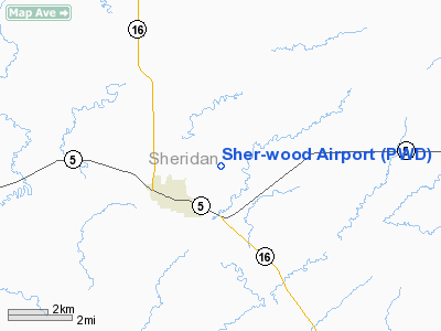
Location & QuickFacts
| FAA Information Effective: | 2008-09-25 |
| Airport Identifier: | PWD |
| Airport Status: | Operational |
| Longitude/Latitude: | 104-31-23.4200W/48-47-19.0800N
-104.523172/48.788633 (Estimated) |
| Elevation: | 2250 ft / 685.80 m (Surveyed) |
| Land: | 600 acres |
| From nearest city: | 1 nautical miles NE of Plentywood, MT |
| Location: | Sheridan County, MT |
| Magnetic Variation: | 10E (1985) |
Owner & Manager
| Ownership: | Publicly owned |
| Owner: | City Of Plentwood & Sher Cty |
| Address: | 100 West Laurel Ave
Plentywood, MT 59254 |
| Phone number: | 406-765-2310 |
| Manager: | Steve Brekke |
| Address: | 100 West Laurel Ave
Plentywood, MT 59254 |
| Phone number: | 406-765-3403 |
Airport Operations and Facilities
| Airport Use: | Open to public |
| Wind indicator: | Yes |
| Segmented Circle: | Yes |
| Control Tower: | No |
| Lighting Schedule: | DUSK-DAWN
ACTVT MIRL RY 12/30 -CTAF. |
| Beacon Color: | Clear-Green (lighted land airport) |
| Landing fee charge: | No |
| Sectional chart: | Billings |
| Region: | ANM - Northwest Mountain |
| Boundary ARTCC: | ZLC - Salt Lake City |
| Tie-in FSS: | GTF - Great Falls |
| FSS on Airport: | No |
| FSS Toll Free: | 1-800-WX-BRIEF |
| NOTAMs Facility: | GTF (NOTAM-d service avaliable) |
| Federal Agreements: | NGY |
Airport Communications
| CTAF: | 122.800 |
| Unicom: | 122.800 |
Airport Services
| Fuel available: | 100LL
24 HR SELF SVC CREDIT CARD FUEL FAC. |
| Airframe Repair: | NONE |
| Power Plant Repair: | NONE |
| Bottled Oxygen: | NONE |
| Bulk Oxygen: | NONE |
Runway Information
Runway 08/26
| Dimension: | 2950 x 60 ft / 899.2 x 18.3 m |
| Surface: | TURF, Fair Condition |
| |
Runway 08 |
Runway 26 |
| Traffic Pattern: | Left | Left |
|
Runway 12/30
| Dimension: | 3900 x 75 ft / 1188.7 x 22.9 m |
| Surface: | ASPH, Good Condition |
| Weight Limit: | Single wheel: 12500 lbs. |
| Edge Lights: | Medium |
| |
Runway 12 |
Runway 30 |
| Longitude: | 104-31-45.0000W | 104-31-01.8500W |
| Latitude: | 48-47-32.0000N | 48-47-06.1600N |
| Elevation: | 2250.00 ft | 2236.00 ft |
| Alignment: | 127 | 127 |
| Traffic Pattern: | Left | Left |
| Markings: | Basic, Fair Condition | Basic, Fair Condition |
| Crossing Height: | 44.00 ft | 44.00 ft |
| VASI: | 2-light PAPI on left side
RY 12 PAPI OTS INDEFLY. | 2-light PAPI on left side |
| Visual Glide Angle: | 3.00° | 3.00° |
| Obstruction: | 21 ft road, 1006.0 ft from runway, 38:1 slope to clear | , 50:1 slope to clear |
|
Runway 16/34
| Dimension: | 1600 x 83 ft / 487.7 x 25.3 m |
| Surface: | TURF, Fair Condition |
| |
Runway 16 |
Runway 34 |
| Traffic Pattern: | Left | Left |
|
Radio Navigation Aids
| ID |
Type |
Name |
Ch |
Freq |
Var |
Dist |
| PWD | NDB | Plentywood | | 251.00 | 16E | 0.2 nm |
| SCO | NDB | Scobey | | 283.00 | 16E | 36.2 nm |
| ISN | VORTAC | Williston | 110X | 116.30 | 12E | 44.5 nm |
Remarks
- NO SNOW REMOVAL ON TURF RUNWAYS.
Images and information placed above are from
http://www.airport-data.com/airport/PWD/
We thank them for the data!
| General Info
|
| Country |
United States
|
| State |
MONTANA
|
| FAA ID |
PWD
|
| Latitude |
48-47-25.101N
|
| Longitude |
104-32-01.842W
|
| Elevation |
2250 feet
|
| Near City |
PLENTYWOOD
|
We don't guarantee the information is fresh and accurate. The data may
be wrong or outdated.
For more up-to-date information please refer to other sources.
|
|


