 |
|
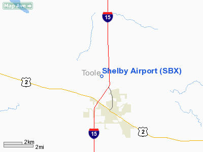
Location & QuickFacts
| FAA Information Effective: | 2008-09-25 |
| Airport Identifier: | SBX |
| Airport Status: | Operational |
| Longitude/Latitude: | 111-52-16.4900W/48-32-26.4200N
-111.871247/48.540672 (Estimated) |
| Elevation: | 3443 ft / 1049.43 m (Estimated) |
| Land: | 634 acres |
| From nearest city: | 2 nautical miles N of Shelby, MT |
| Location: | Toole County, MT |
| Magnetic Variation: | 18E (1985) |
Owner & Manager
| Ownership: | Publicly owned |
| Owner: | Toole County |
| Address: | 226 1st St. So.
Shelby, MT 59474-1920 |
| Phone number: | 406-424-8310 |
| Manager: | Jerry Larson Jr |
| Address: | Po Box 210
Shelby, MT 59474 |
| Phone number: | 406-434-2462
OR CALL 406-450-2463. |
Airport Operations and Facilities
| Airport Use: | Open to public |
| Wind indicator: | Yes |
| Segmented Circle: | Yes |
| Control Tower: | No |
| Lighting Schedule: | DUSK-DAWN
ACTVT MIRL RYS 05/23 & 11/29 AND PAPI RYS 05, 23, 11, & 29 - CTAF. |
| Beacon Color: | Clear-Green (lighted land airport) |
| Landing fee charge: | No |
| Sectional chart: | Great Falls |
| Region: | ANM - Northwest Mountain |
| Boundary ARTCC: | ZLC - Salt Lake City |
| Tie-in FSS: | GTF - Great Falls |
| FSS on Airport: | No |
| FSS Toll Free: | 1-800-WX-BRIEF |
| NOTAMs Facility: | GTF (NOTAM-d service avaliable) |
| Federal Agreements: | NGY |
Airport Communications
| CTAF: | 122.800 |
| Unicom: | 122.800 |
Airport Services
| Fuel available: | 100LLA
FOR FUEL AFTER HRS CALL 406-450-2461 OR 450-2463 |
| Airframe Repair: | NONE |
| Power Plant Repair: | NONE |
| Bottled Oxygen: | NONE |
| Bulk Oxygen: | NONE |
Runway Information
Runway 05/23
| Dimension: | 5004 x 75 ft / 1525.2 x 22.9 m |
| Surface: | ASPH, Good Condition |
| Surface Treatment: | Porous Friction Course |
| Weight Limit: | Single wheel: 12500 lbs. |
| Edge Lights: | Medium |
| |
Runway 05 |
Runway 23 |
| Longitude: | 111-52-53.1200W | 111-51-45.7900W |
| Latitude: | 48-32-18.0770N | 48-32-38.9300N |
| Elevation: | 3414.00 ft | 3443.00 ft |
| Alignment: | 65 | 127 |
| Traffic Pattern: | Left | Left |
| Markings: | Basic, Good Condition | Non-precision instrument, Good Condition |
| Crossing Height: | 29.00 ft | 32.00 ft |
| VASI: | 2-light PAPI on left side | 2-light PAPI on left side |
| Visual Glide Angle: | 3.00° | 3.00° |
| Obstruction: | , 50:1 slope to clear | 30 ft road, 1060.0 ft from runway, 379 ft right of centerline, 28:1 slope to clear |
|
Runway 11/29
| Dimension: | 3701 x 60 ft / 1128.1 x 18.3 m |
| Surface: | ASPH, Good Condition |
| Surface Treatment: | Porous Friction Course |
| Weight Limit: | Single wheel: 12500 lbs. |
| Edge Lights: | Medium |
| |
Runway 11 |
Runway 29 |
| Longitude: | 111-52-33.9030W | 111-51-51.1280W |
| Latitude: | 48-32-35.1620N | 48-32-12.2170N |
| Elevation: | 3417.00 ft | 3428.00 ft |
| Alignment: | 127 | 127 |
| Traffic Pattern: | Left | Left |
| Markings: | Basic, Good Condition | Basic, Good Condition |
| Crossing Height: | 31.00 ft | 38.00 ft |
| VASI: | 2-light PAPI on left side | 2-light PAPI on left side |
| Visual Glide Angle: | 3.00° | 3.00° |
| Obstruction: | , 50:1 slope to clear | 28 ft lgt pole, 1156.0 ft from runway, 102 ft right of centerline, 34:1 slope to clear |
|
Radio Navigation Aids
| ID |
Type |
Name |
Ch |
Freq |
Var |
Dist |
| SBX | NDB | Shelby | | 347.00 | 18E | 0.4 nm |
| CRD | NDB | Conrad | | 293.00 | 17E | 21.4 nm |
| LTY | NDB | Chester | | 323.00 | 15E | 35.5 nm |
| CII | NDB | Choteau | | 269.00 | 17E | 44.8 nm |
| CTB | VORTAC | Cut Bank | 091X | 114.40 | 17E | 18.8 nm |
Remarks
- DEER ON & INVOF ARPT.
- TWYS MARKED WITH REFLECTORS.
Images and information placed above are from
http://www.airport-data.com/airport/SBX/
We thank them for the data!
| General Info
|
| Country |
United States
|
| State |
MONTANA
|
| FAA ID |
SBX
|
| Latitude |
48-32-28.510N
|
| Longitude |
111-52-19.460W
|
| Elevation |
3437 feet
|
| Near City |
SHELBY
|
We don't guarantee the information is fresh and accurate. The data may
be wrong or outdated.
For more up-to-date information please refer to other sources.
|
|


