 |
|
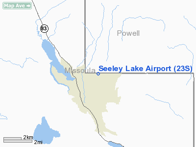
Location & QuickFacts
| FAA Information Effective: | 2008-09-25 |
| Airport Identifier: | 23S |
| Airport Status: | Operational |
| Longitude/Latitude: | 113-26-43.2710W/47-10-44.7700N
-113.445353/47.179103 (Estimated) |
| Elevation: | 4235 ft / 1290.83 m (Estimated) |
| Land: | 48 acres |
| From nearest city: | 2 nautical miles E of Seeley Lake, MT |
| Location: | Missoula County, MT |
| Magnetic Variation: | 18E (1985) |
Owner & Manager
| Ownership: | Publicly owned |
| Owner: | Mt Aeronautics Division |
| Address: | Po Box 200507
Helena, MT 59620-0507 |
| Phone number: | 406-444-2506 |
| Manager: | Mt Aeronautics |
| Address: | Po Box 200507
Helena, MT 59620-0507 |
| Phone number: | 406-444-2506 |
Airport Operations and Facilities
| Airport Use: | Open to public |
| Wind indicator: | Yes |
| Segmented Circle: | Yes |
| Control Tower: | No |
| Landing fee charge: | No |
| Sectional chart: | Great Falls |
| Region: | ANM - Northwest Mountain |
| Boundary ARTCC: | ZLC - Salt Lake City |
| Tie-in FSS: | GTF - Great Falls |
| FSS on Airport: | No |
| FSS Toll Free: | 1-800-WX-BRIEF |
| NOTAMs Facility: | GTF (NOTAM-d service avaliable) |
Airport Communications
Airport Services
| Airframe Repair: | NONE |
| Power Plant Repair: | NONE |
| Bottled Oxygen: | NONE |
| Bulk Oxygen: | NONE |
Runway Information
Runway 16/34
| Dimension: | 4575 x 75 ft / 1394.5 x 22.9 m |
| Surface: | TURF, Good Condition
SFC VERY SOFT AND MUDDY WHEN WET. |
| |
Runway 16 |
Runway 34 |
| Traffic Pattern: | Left | Left |
| Markings: | Nonstandard,
RWY 16 RY 16/34 CONES W/REFLECTORS ALONG FULL LENGTH OF RY EXCP DURG WINTER MONTHS. | , |
| Obstruction: | 105 ft trees, 1044.0 ft from runway, 30 ft left of centerline, 10:1 slope to clear | 50 ft trees, 1260.0 ft from runway, 72 ft left of centerline, 25:1 slope to clear |
|
Radio Navigation Aids
| ID |
Type |
Name |
Ch |
Freq |
Var |
Dist |
| INE | NDB | Konna | | 521.00 | 17E | 39.2 nm |
| PLS | NDB | Polson | | 275.00 | 20E | 43.3 nm |
| DRU | VOR | Drummond | | 117.10 | 17E | 34.3 nm |
| MSO | VOR/DME | Missoula | 075X | 112.80 | 17E | 30.8 nm |
Remarks
- TKOFS TO NORTH NOT RECOMMENDED DUE TO RISING TERRAIN.
- TREES IN TRANSITIONAL SFC FULL RY LENGTH BOTH SIDES.
- ULTRALIGHTS ON & INVOF ARPT.
- BIRDS & WILDLIFE ON & INVOF ARPT.
- SNOW REMOVAL INTERMITTENT, CALL AMGR FOR CURRENT CONDITIONS 406-444-2506.
Images and information placed above are from
http://www.airport-data.com/airport/23S/
We thank them for the data!
| General Info
|
| Country |
United States
|
| State |
MONTANA
|
| FAA ID |
23S
|
| Latitude |
47-10-44.770N
|
| Longitude |
113-26-43.271W
|
| Elevation |
4235 feet
|
| Near City |
SEELEY LAKE
|
We don't guarantee the information is fresh and accurate. The data may
be wrong or outdated.
For more up-to-date information please refer to other sources.
|
|


