 |
|
| Scobey Airport |
| IATA: none – ICAO: none – FAA LID: 9S2 |
| Summary |
| Airport type |
Public |
| Owner |
City of Scobey & Daniels County |
| Serves |
Scobey, Montana |
| Elevation AMSL |
2,432 ft / 741 m |
| Coordinates |
48°48′28″N 105°26′22″W / 48.80778°N 105.43944°W / 48.80778; -105.43944 |
| Runways |
| Direction |
Length |
Surface |
| ft |
m |
| 12/30 |
4,015 |
1,224 |
Asphalt |
| Statistics (2006) |
| Aircraft operations |
4,450 |
| Source: Federal Aviation Administration |
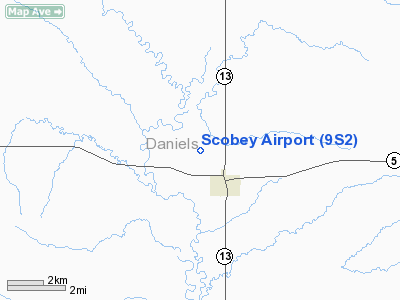
Scobey Airport (FAA LID: 9S2) is a public airport located one mile (2 km) northwest of the central business district of Scobey, a city in Daniels County, Montana, United States. It is owned by the City of Scobey and Daniels County.
Facilities and aircraft
Scobey Airport covers an area of 175 acres (71 ha) and has one runway designated 12/30 with a 4,015 x 75 ft (1,224 x 23 m) asphalt surface. For the 12-month period ending July 25, 2006, the airport had 4,450 aircraft operations, an average of 12 per day: 91% general aviation and 9% air taxi.
The above content comes from Wikipedia and is published under free licenses – click here to read more.
Location & QuickFacts
| FAA Information Effective: | 2008-09-25 |
| Airport Identifier: | 9S2 |
| Airport Status: | Operational |
| Longitude/Latitude: | 105-26-22.0920W/48-48-27.8180N
-105.439470/48.807727 (Estimated) |
| Elevation: | 2432 ft / 741.27 m (Surveyed) |
| Land: | 175 acres |
| From nearest city: | 1 nautical miles NW of Scobey, MT |
| Location: | Daniels County, MT |
| Magnetic Variation: | 12E (2000) |
Owner & Manager
| Ownership: | Publicly owned |
| Owner: | Scobey Daniels Co |
| Address: | County Courthouse
Scobey, MT 59263 |
| Phone number: | 406-487-5561 |
| Manager: | Charles Trower |
| Address: | Box 530
Scobey, MT 59263 |
| Phone number: | 406-487-2725 |
Airport Operations and Facilities
| Airport Use: | Open to public |
| Wind indicator: | Yes |
| Segmented Circle: | Yes |
| Control Tower: | No |
| Lighting Schedule: | DUSK-DAWN
MIRL RY 12/30 & PAPI RY 12 & 30 OPER DUSK-2300; AFT 2300 ACTVT - CTAF. |
| Beacon Color: | Clear-Green (lighted land airport) |
| Landing fee charge: | No |
| Sectional chart: | Billings |
| Region: | ANM - Northwest Mountain |
| Boundary ARTCC: | ZLC - Salt Lake City |
| Tie-in FSS: | GTF - Great Falls |
| FSS on Airport: | No |
| FSS Toll Free: | 1-800-WX-BRIEF |
| NOTAMs Facility: | GTF (NOTAM-d service avaliable) |
| Federal Agreements: | NGY |
Airport Communications
| CTAF: | 122.800 |
| Unicom: | 122.800
AUTOMATED UNICOM. |
Airport Services
| Fuel available: | 100LLA
FOR FUEL AFTER HRS CALL 406-487-5544 |
| Airframe Repair: | MAJOR |
| Power Plant Repair: | MAJOR |
| Bottled Oxygen: | NONE |
| Bulk Oxygen: | NONE |
Runway Information
Runway 12/30
| Dimension: | 4015 x 75 ft / 1223.8 x 22.9 m |
| Surface: | ASPH, Good Condition |
| Weight Limit: | Single wheel: 11000 lbs. |
| Edge Lights: | Medium |
| |
Runway 12 |
Runway 30 |
| Longitude: | 105-26-43.6810W | 105-26-00.5020W |
| Latitude: | 48-48-41.5660N | 48-48-14.0690N |
| Elevation: | 2385.00 ft | 2432.00 ft |
| Alignment: | 127 | 127 |
| Traffic Pattern: | Left | Left |
| Markings: | Basic, Good Condition | Basic, Good Condition |
| Crossing Height: | 25.00 ft | 25.00 ft |
| VASI: | 2-light PAPI on left side | 2-light PAPI on left side |
| Visual Glide Angle: | 3.00° | 3.00° |
| Obstruction: | , 50:1 slope to clear | 15 ft road, 606.0 ft from runway, 27:1 slope to clear |
|
Radio Navigation Aids
| ID |
Type |
Name |
Ch |
Freq |
Var |
Dist |
| SCO | NDB | Scobey | | 283.00 | 16E | 0.1 nm |
| PWD | NDB | Plentywood | | 251.00 | 16E | 36.1 nm |
| OLF | NDB | Wolf Point | | 404.00 | 11E | 42.8 nm |
Remarks
Images and information placed above are from
http://www.airport-data.com/airport/9S2
We thank them for the data!
| General Info
|
| Country |
United States
|
| State |
MONTANA
|
| FAA ID |
9S2
|
| Latitude |
48-48-27.818N
|
| Longitude |
105-26-22.092W
|
| Elevation |
2432 feet
|
| Near City |
SCOBEY
|
We don't guarantee the information is fresh and accurate. The data may
be wrong or outdated.
For more up-to-date information please refer to other sources.
|
|


