 |
|
Scobey Border Station /east Poplar Intl/ Airport |
|
|
| Coronach/Scobey Border Station Airport Scobey Border Station Airport East Poplar International Airport |
| IATA: none – ICAO: none – FAA LID: 8U3 – TC LID: CKK3
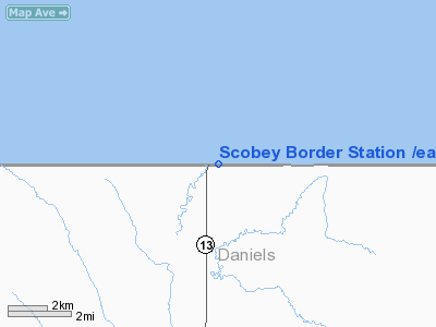
Location of Coronach/Scobey Border Station Airport
|
| Summary |
| Airport type |
Public |
| Owner |
U.S. and Canadian Governments |
| Operator |
Montana Aeronautics Division |
| Serves |
Coronach, Saskatchewan
Scobey, Montana |
| Location |
Hart Butte No. 11, Saskatchewan, Canada / Daniels County, Montana, USA |
| Elevation AMSL |
2,501 ft / 762 m |
| Coordinates |
49°00′00″N 105°23′56″W / 49°N 105.39889°W / 49; -105.39889 (Coronach/Scobey Border Station Airport)Coordinates: 49°00′00″N 105°23′56″W / 49°N 105.39889°W / 49; -105.39889 (Coronach/Scobey Border Station Airport)
49°00′00″N 105°24′02″W / 49°N 105.40056°W / 49; -105.40056 (East Poplar International Airport)Coordinates: 49°00′00″N 105°24′02″W / 49°N 105.40056°W / 49; -105.40056 (East Poplar International Airport) |
| Runways |
| Direction |
Length |
Surface |
| ft |
m |
08/26
7/25 |
3,330 |
1,015 |
Turf |
| Statistics (2008) |
| Aircraft operations |
10 |
| Sources: Canada Flight Supplement and Federal Aviation Administration |
Coronach/Scobey Border Station Airport (FAA LID: 8U3, TC LID: CKK3) is located 8 NM (15 km; 9.2 mi) southeast of Coronach, Saskatchewan, Canada and 13 mi (21 km) north of Scobey, Montana, United States. In the United States, the airport is known by the names Scobey Border Station Airport and East Poplar International Airport. It is owned by the U.S. and Canadian governments.
The runway lies exactly along the Canada-United States border and is adjacent to the border crossing between the two aforementioned towns. Customs may be cleared on either side of the border, but customs officials require two hours' advance notice prior to landing, and landings are allowed only during the border crossing's normal hours of operation.
The airport is classified as an airport of entry by NAV CANADA and is staffed by the Canada Border Services Agency. CBSA officers at this airport currently can handle general aviation aircraft only, with no more than fifteen passengers.
Facilities and aircraft
The airport covers an area of 6 acres (2.4 ha) and has one runway with a 3,330 by 75 ft (1,010 by 23 m) turf surface. Canadian records list it as Runway 08/26 while U.S. records refer to it as Runway 7/25.. For the 12-month period ending September 9, 2008, the airport had 10 general aviation aircraft operations.
The above content comes from Wikipedia and is published under free licenses – click here to read more.
Location & QuickFacts
| FAA Information Effective: | 2008-09-25 |
| Airport Identifier: | 8U3 |
| Airport Status: | Operational |
| Longitude/Latitude: | 105-24-01.9800W/49-00-00.0870N
-105.400550/49.000024 (Estimated) |
| Elevation: | 2501 ft / 762.30 m (Surveyed) |
| Land: | 6 acres |
| From nearest city: | 13 nautical miles N of Scobey, MT |
| Location: | Daniels County, MT |
| Magnetic Variation: | 14E (1985) |
Owner & Manager
| Ownership: | Publicly owned |
| Owner: | U S And Canadian Govts |
| Address: | Po Box 200507
Helena, MT 59620-0507 |
| Phone number: | 406-444-2506 |
| Manager: | Mt Aero Division |
| Address: | Po Box 200507
Helena, MT 59620-0507 |
| Phone number: | 406-444-2506
OR CANADIAN CUSTOMS (306) 267-2177 |
Airport Operations and Facilities
| Airport Use: | Open to public |
| Wind indicator: | Yes |
| Segmented Circle: | Yes |
| Control Tower: | No |
| Landing fee charge: | No |
| Sectional chart: | Billings |
| Region: | ANM - Northwest Mountain |
| Boundary ARTCC: | ZLC - Salt Lake City |
| Tie-in FSS: | GTF - Great Falls |
| FSS on Airport: | No |
| FSS Toll Free: | 1-800-WX-BRIEF |
| NOTAMs Facility: | GTF (NOTAM-d service avaliable) |
Airport Communications
Airport Services
| Airframe Repair: | NONE |
| Power Plant Repair: | NONE |
| Bottled Oxygen: | NONE |
| Bulk Oxygen: | NONE |
Runway Information
Runway 07/25
| Dimension: | 3330 x 75 ft / 1015.0 x 22.9 m |
| Surface: | TURF, Fair Condition
SURFACE ROLLING WITH GOPHER HOLES. |
| |
Runway 07 |
Runway 25 |
| Traffic Pattern: | Left | Left |
| Obstruction: | 21 ft pole, 237.0 ft from runway, 20 ft right of centerline, 11:1 slope to clear | , 50:1 slope to clear |
|
Radio Navigation Aids
| ID |
Type |
Name |
Ch |
Freq |
Var |
Dist |
| SCO | NDB | Scobey | | 283.00 | 16E | 11.6 nm |
| PWD | NDB | Plentywood | | 251.00 | 16E | 36.7 nm |
Remarks
- RY 07/25 SOFT WHEN WET.
- RY 07 HAS +6 FT FENCE 59 FT R; PARALLELING RY FM THLD TO 245 FT +5 FT BORDER MARKER 227 FT FM THLD ON RY CNTRLN; +12 FT TREES & BRUSH 335 FT FM RY THLD 64 FT L TO 345 FT FM RY THLD PARALLELING RY; +21 BORDER GATE 285 FT FM THLD 60 FT R.
- NO SNOW REMOVAL.
Images and information placed above are from
http://www.airport-data.com/airport/8U3/
We thank them for the data!
| General Info
|
| Country |
United States
|
| State |
MONTANA
|
| FAA ID |
8U3
|
| Latitude |
49-00-00.087N
|
| Longitude |
105-24-01.980W
|
| Elevation |
2501 feet
|
| Near City |
SCOBEY
|
We don't guarantee the information is fresh and accurate. The data may
be wrong or outdated.
For more up-to-date information please refer to other sources.
|
|


