 |
|
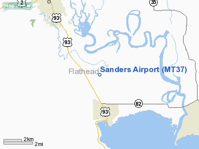
Location & QuickFacts
| FAA Information Effective: | 2008-09-25 |
| Airport Identifier: | MT37 |
| Airport Status: | Operational |
| Longitude/Latitude: | 114-14-25.4510W/48-07-28.8400N
-114.240403/48.124678 (Estimated) |
| Elevation: | 2910 ft / 886.97 m (Estimated) |
| Land: | 5 acres |
| From nearest city: | 6 nautical miles SE of Kalispell, MT |
| Location: | Flathead County, MT |
| Magnetic Variation: | 18E (1990) |
Owner & Manager
| Ownership: | Privately owned |
| Owner: | Ray G./darlene V. Sanders |
| Address: | 545 Somers Stage
Kalispell, MT 59901 |
| Phone number: | 406-752-3591 |
| Manager: | Raymond G. Sanders |
| Address: | 545 Somers Stage
Kalispell, MT 59901 |
| Phone number: | 406-752-3591 |
Airport Operations and Facilities
| Airport Use: | Private |
| Wind indicator: | Yes |
| Segmented Circle: | No |
| Control Tower: | No |
| Sectional chart: | Great Falls |
| Region: | ANM - Northwest Mountain |
| Boundary ARTCC: | ZLC - Salt Lake City |
| Tie-in FSS: | GTF - Great Falls |
| FSS Toll Free: | 1-800-WX-BRIEF |
Runway Information
Runway 16/34
| Dimension: | 2600 x 50 ft / 792.5 x 15.2 m |
| Surface: | TURF, |
| |
Runway 16 |
Runway 34 |
| Traffic Pattern: | Left | Left |
| Obstruction: | | 30 ft pline, 300.0 ft from runway |
|
Radio Navigation Aids
| ID |
Type |
Name |
Ch |
Freq |
Var |
Dist |
| SAK | NDB | Smith Lake | | 515.00 | 18E | 8.9 nm |
| PLS | NDB | Polson | | 275.00 | 20E | 25.9 nm |
| FCA | VOR/DME | Kalispell | 079X | 113.20 | 18E | 6.0 nm |
Images and information placed above are from
http://www.airport-data.com/airport/MT37/
We thank them for the data!
| General Info
|
| Country |
United States
|
| State |
MONTANA
|
| FAA ID |
MT37
|
| Latitude |
48-07-28.840N
|
| Longitude |
114-14-25.451W
|
| Elevation |
2910 feet
|
| Near City |
KALISPELL
|
We don't guarantee the information is fresh and accurate. The data may
be wrong or outdated.
For more up-to-date information please refer to other sources.
|
|


