 |
|
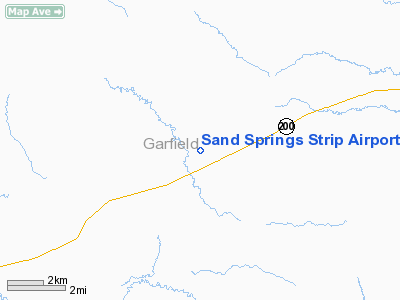
Sand Springs Strip Airport |
Location & QuickFacts
| FAA Information Effective: | 2008-09-25 |
| Airport Identifier: | 8U1 |
| Airport Status: | Operational |
| Longitude/Latitude: | 107-30-12.3410W/47-06-14.9890N
-107.503428/47.104164 (Estimated) |
| Elevation: | 3180 ft / 969.26 m (Estimated) |
| Land: | 25 acres |
| From nearest city: | 1 nautical miles NW of Sand Springs, MT |
| Location: | Garfield County, MT |
| Magnetic Variation: | 14E (1985) |
Owner & Manager
| Ownership: | Privately owned |
| Owner: | Dutton Enterprises |
| Address: | Box C-5
Sand Springs, MT 59077 |
| Phone number: | 406-746-3420 |
| Manager: | Leo Dutton |
| Address: | Box C-5
Sand Springs, MT 59077 |
| Phone number: | 406-449-8182 |
Airport Operations and Facilities
| Airport Use: | Open to public |
| Wind indicator: | Yes |
| Segmented Circle: | No |
| Control Tower: | No |
| Landing fee charge: | No |
| Sectional chart: | Billings |
| Region: | ANM - Northwest Mountain |
| Traffic Pattern Alt: | 720 ft |
| Boundary ARTCC: | ZLC - Salt Lake City |
| Tie-in FSS: | GTF - Great Falls |
| FSS on Airport: | No |
| FSS Toll Free: | 1-800-WX-BRIEF |
| NOTAMs Facility: | GTF (NOTAM-d service avaliable) |
Airport Communications
| CTAF: | 122.800 |
| Unicom: | 122.800
UNICOM LCTD AT SAND SPRINGS STORE 1/2 MILE EAST OF ARPT. |
Airport Services
| Fuel available: | 100
CTC UNICOM FOR FUEL OR CALL AHEAD 406-746-3420. |
| Airframe Repair: | NONE |
| Power Plant Repair: | NONE |
| Bottled Oxygen: | NONE |
| Bulk Oxygen: | NONE |
Runway Information
Runway 10/28
| Dimension: | 2400 x 60 ft / 731.5 x 18.3 m |
| Surface: | GRVL, Fair Condition |
| |
Runway 10 |
Runway 28 |
| Traffic Pattern: | Left | Left |
| Runway End Identifier: | No | No |
| Centerline Lights: | No | No |
| Touchdown Lights: | No | No |
| Obstruction: | 17 ft road, 132.0 ft from runway, 7:1 slope to clear | , 50:1 slope to clear |
|
Radio Navigation Aids
| ID |
Type |
Name |
Ch |
Freq |
Var |
Dist |
| JDN | NDB | Jordan | | 263.00 | 16E | 26.9 nm |
Remarks
- ANIMALS ON & INVOF RY.
- NO LANDING ON TWY CONNECTED TO RY 28.
- RY 10/28 MAY BE SOFT WHEN WET.
Images and information placed above are from
http://www.airport-data.com/airport/8U1/
We thank them for the data!
| General Info
|
| Country |
United States
|
| State |
MONTANA
|
| FAA ID |
8U1
|
| Latitude |
47-06-14.989N
|
| Longitude |
107-30-12.341W
|
| Elevation |
3180 feet
|
| Near City |
SAND SPRINGS
|
We don't guarantee the information is fresh and accurate. The data may
be wrong or outdated.
For more up-to-date information please refer to other sources.
|
|


