 |
|
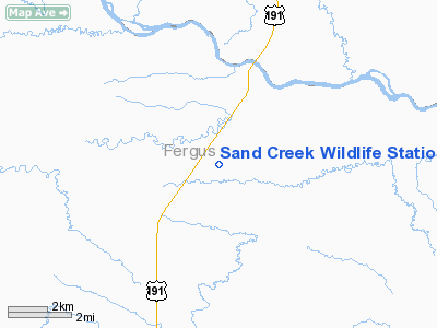
Sand Creek Wildlife Station Airport |
Location & QuickFacts
| FAA Information Effective: | 2008-09-25 |
| Airport Identifier: | MT79 |
| Airport Status: | Operational |
| Longitude/Latitude: | 108-42-32.5470W/47-35-02.9590N
-108.709041/47.584155 (Estimated) |
| Elevation: | 2940 ft / 896.11 m (Estimated) |
| Land: | 20 acres |
| From nearest city: | 18 nautical miles NE of Roy, MT |
| Location: | Fergus County, MT |
| Magnetic Variation: | 16E (1985) |
Owner & Manager
| Ownership: | Publicly owned |
| Owner: | U.s. Fish & Wildlife Service |
| Address: | P.o. Box 89
Roy, MT 59471 |
| Phone number: | 406-464-5181 |
| Manager: | Refuge Manager Sand Creek Station |
| Address: | P.o. Box 89
Roy, MT 59471 |
| Phone number: | 406-464-5181 |
Airport Operations and Facilities
| Airport Use: | Private |
| Wind indicator: | Yes |
| Segmented Circle: | No |
| Control Tower: | No |
| Sectional chart: | Billings |
| Region: | ANM - Northwest Mountain |
| Boundary ARTCC: | ZLC - Salt Lake City |
| Tie-in FSS: | GTF - Great Falls |
| FSS Toll Free: | 1-800-WX-BRIEF |
Runway Information
Runway 08/26
| Dimension: | 2600 x 50 ft / 792.5 x 15.2 m |
| Surface: | TURF, |
| |
Runway 08 |
Runway 26 |
| Traffic Pattern: | Left | Left |
|
Radio Navigation Aids
| ID |
Type |
Name |
Ch |
Freq |
Var |
Dist |
| LWT | NDB | Lewistown | | 353.00 | 17E | 45.8 nm |
| LWT | VORTAC | Lewistown | 057X | 112.00 | 15E | 48.5 nm |
Remarks
- FILED FOR RECORD PURPOSES ONLY.
Images and information placed above are from
http://www.airport-data.com/airport/MT79/
We thank them for the data!
| General Info
|
| Country |
United States
|
| State |
MONTANA
|
| FAA ID |
MT79
|
| Latitude |
47-35-02.959N
|
| Longitude |
108-42-32.547W
|
| Elevation |
2940 feet
|
| Near City |
ROY
|
We don't guarantee the information is fresh and accurate. The data may
be wrong or outdated.
For more up-to-date information please refer to other sources.
|
|


