 |
|
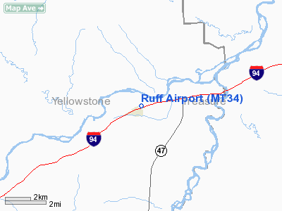
Location & QuickFacts
| FAA Information Effective: | 2008-09-25 |
| Airport Identifier: | MT34 |
| Airport Status: | Operational |
| Longitude/Latitude: | 107-33-02.2700W/46-07-59.9500N
-107.550631/46.133319 (Estimated) |
| Elevation: | 2740 ft / 835.15 m (Estimated) |
| Land: | 0 acres |
| From nearest city: | 0 nautical miles N of Custer, MT |
| Location: | Yellowstone County, MT |
| Magnetic Variation: | 14E (1985) |
Owner & Manager
| Ownership: | Privately owned |
| Owner: | Ruff Inc. |
| Address: | P.o. Box 106
Custer, MT 59024 |
| Phone number: | 406-856-4164 |
| Manager: | Leslie Ruff |
| Address: | P.o. Box 106
Custer, MT 59024 |
| Phone number: | 406-856-4164 |
Airport Operations and Facilities
| Airport Use: | Private |
| Wind indicator: | Yes |
| Segmented Circle: | No |
| Control Tower: | No |
| Landing fee charge: | No |
| Sectional chart: | Billings |
| Region: | ANM - Northwest Mountain |
| Boundary ARTCC: | ZLC - Salt Lake City |
| Tie-in FSS: | GTF - Great Falls |
| FSS on Airport: | No |
| FSS Toll Free: | 1-800-WX-BRIEF |
Runway Information
Runway 06/24
| Dimension: | 2500 x 50 ft / 762.0 x 15.2 m |
| Surface: | TURF, |
| |
Runway 06 |
Runway 24 |
| Traffic Pattern: | Left | Left |
|
Radio Navigation Aids
| ID |
Type |
Name |
Ch |
Freq |
Var |
Dist |
| FOR | NDB | Forsyth | | 236.00 | 14E | 43.7 nm |
| RPX | NDB | Roundup | | 362.00 | 17E | 47.1 nm |
| BIL | VORTAC | Billings | 092X | 114.50 | 14E | 48.9 nm |
Remarks
Images and information placed above are from
http://www.airport-data.com/airport/MT34/
We thank them for the data!
| General Info
|
| Country |
United States
|
| State |
MONTANA
|
| FAA ID |
MT34
|
| Latitude |
46-07-59.950N
|
| Longitude |
107-33-02.270W
|
| Elevation |
2740 feet
|
| Near City |
CUSTER
|
We don't guarantee the information is fresh and accurate. The data may
be wrong or outdated.
For more up-to-date information please refer to other sources.
|
|


