 |
|
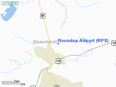
Location & QuickFacts
| FAA Information Effective: | 2008-09-25 |
| Airport Identifier: | RPX |
| Airport Status: | Operational |
| Longitude/Latitude: | 108-32-36.2290W/46-28-29.9940N
-108.543397/46.474998 (Estimated) |
| Elevation: | 3491 ft / 1064.06 m (Surveyed) |
| Land: | 367 acres |
| From nearest city: | 2 nautical miles N of Roundup, MT |
| Location: | Musselshell County, MT |
| Magnetic Variation: | 15E (1985) |
Owner & Manager
| Ownership: | Publicly owned |
| Owner: | Roundup & Musselshell County |
| Address: | 506 Main Street
Roundup, MT 59072 |
| Phone number: | 406-323-1104 |
| Manager: | Doug Parrott |
| Address: | Box 306
Roundup, MT 59072 |
| Phone number: | 406-323-1662
OR 406-323-1518. |
Airport Operations and Facilities
| Airport Use: | Open to public |
| Wind indicator: | Yes |
| Segmented Circle: | Yes |
| Control Tower: | No |
| Lighting Schedule: | DUSK-DAWN
ACTVT PAPI RY 24 - CTAF. |
| Beacon Color: | Clear-Green (lighted land airport) |
| Landing fee charge: | No |
| Sectional chart: | Billings |
| Region: | ANM - Northwest Mountain |
| Boundary ARTCC: | ZLC - Salt Lake City |
| Tie-in FSS: | GTF - Great Falls |
| FSS on Airport: | No |
| FSS Toll Free: | 1-800-WX-BRIEF |
| NOTAMs Facility: | GTF (NOTAM-d service avaliable) |
| Federal Agreements: | NGY |
Airport Communications
| CTAF: | 122.800 |
| Unicom: | 122.800
AUTOMATED UNICOM. |
Airport Services
| Fuel available: | 100LLA
CREDIT CARD SELF SVC FUEL AVBL 24/7. |
| Airframe Repair: | MAJOR |
| Power Plant Repair: | MAJOR |
| Bottled Oxygen: | NONE |
| Bulk Oxygen: | NONE |
Runway Information
Runway 06/24
| Dimension: | 5098 x 75 ft / 1553.9 x 22.9 m |
| Surface: | ASPH, Good Condition |
| Weight Limit: | Single wheel: 12500 lbs. |
| Edge Lights: | Medium |
| |
Runway 06 |
Runway 24 |
| Longitude: | 108-33-04.9100W | 108-31-53.7300W |
| Latitude: | 46-28-24.9600N | 46-28-35.6500N |
| Elevation: | 3491.00 ft | 3431.00 ft |
| Alignment: | 78 | 127 |
| Traffic Pattern: | Left | Left |
| Markings: | Basic, Good Condition | Basic, Good Condition |
| Crossing Height: | 0.00 ft | 45.00 ft |
| VASI: | | 2-light PAPI on left side |
| Visual Glide Angle: | 0.00° | 3.00° |
| Obstruction: | 19 ft tree, 1095.0 ft from runway, 104 ft right of centerline, 47:1 slope to clear | , 50:1 slope to clear |
|
Runway 15/33
| Dimension: | 2458 x 100 ft / 749.2 x 30.5 m |
| Surface: | TURF-DIRT, Good Condition |
| |
Runway 15 |
Runway 33 |
| Longitude: | 108-32-54.3000W | 108-32-46.8300W |
| Latitude: | 46-28-41.2000N | 46-28-17.5000N |
| Elevation: | 3463.00 ft | 3481.00 ft |
| Alignment: | 127 | 127 |
| Traffic Pattern: | Left | Left |
| Obstruction: | 13 ft tree, 361.0 ft from runway, 147 ft left of centerline, 27:1 slope to clear | 36 ft trees, 1002.0 ft from runway, 27:1 slope to clear |
|
Radio Navigation Aids
| ID |
Type |
Name |
Ch |
Freq |
Var |
Dist |
| RPX | NDB | Roundup | | 362.00 | 17E | 1.0 nm |
| BIL | VORTAC | Billings | 092X | 114.50 | 14E | 40.2 nm |
Remarks
- PHONE ON FLD.
- MAJOR AIRFRAME & PWR PLANT REPAIRS
- RADIO CONTROLLED AIRPLANE OPNS ON ARPT.
- WILDLIFE ON & INVOF ARPT.
Images and information placed above are from
http://www.airport-data.com/airport/RPX/
We thank them for the data!
| General Info
|
| Country |
United States
|
| State |
MONTANA
|
| FAA ID |
RPX
|
| Latitude |
46-28-24.871N
|
| Longitude |
108-33-27.480W
|
| Elevation |
3485 feet
|
| Near City |
ROUNDUP
|
We don't guarantee the information is fresh and accurate. The data may
be wrong or outdated.
For more up-to-date information please refer to other sources.
|
|


