 |
|
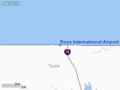
Ross International Airport |
Coutts/Ross International Airport
Ross International Airport |
| IATA: none – ICAO: none – FAA LID: 7S8 – TC LID: CEP4 |
| Summary |
| Airport type |
Public |
| Owner |
State of Montana |
| Operator |
Montana Aeronautics Division |
| Serves |
Coutts, Alberta
Sweet Grass, Montana |
| Location |
Canada – United States border |
| Elevation AMSL |
3,550 ft / 1,082 m
3,552 ft / 1,083 m |
| Coordinates |
48°59′55″N 111°58′39″W / 48.99861°N 111.9775°W / 48.99861; -111.9775 (Ross International Airport)
49°00′00″N 111°58′00″W / 49°N 111.9666667°W / 49; -111.9666667 (Coutts/Ross International Airport) |
| Runways |
| Direction |
Length |
Surface |
| ft |
m |
| 07/25 |
2,900 |
884 |
Turf |
| Statistics (2007/2008) |
| Aircraft operations |
25 |
| Source: Canada Flight Supplement and Federal Aviation Administration |
Coutts/Ross International Airport (FAA LID: 7S8, TC LID: CEP4) is located 0.5 nautical miles (0.9 km) west of Coutts, Alberta, Canada and 0.1 NM (0.2 km) west of Sweet Grass, Montana, United States.
Ross International Airport is owned by the U.S. state of Montana and operated by the Montana Aeronautics Division. Its runway is located on the Canada – United States border.
The airport is classified as an airport of entry by NAV CANADA and is staffed by the Canada Border Services Agency. CBSA officers at this airport currently can handle general aviation aircraft only, with no more than 15 passengers.
Facilities and aircraft
The airport covers an area of 20 acres (8.1 ha) at an elevation of 3,552 feet (1,083 m) above mean sea level. It has one runway designated 7/25 with a turf surface measuring 2,900 by 80 feet (884 x 24 m). For the 12-month period ending August 23, 2008, the airport had 25 general aviation aircraft operations, an average of 2 per month.
The above content comes from Wikipedia and is published under free licenses – click here to read more.
Location & QuickFacts
| FAA Information Effective: | 2008-09-25 |
| Airport Identifier: | 7S8 |
| Airport Status: | Operational |
| Longitude/Latitude: | 111-58-39.1540W/48-59-54.9910N
-111.977543/48.998609 (Estimated) |
| Elevation: | 3552 ft / 1082.65 m (Surveyed) |
| Land: | 20 acres |
| From nearest city: | 1 nautical miles W of Sweetgrass, MT |
| Location: | Toole County, MT |
| Magnetic Variation: | 18E (1985) |
Owner & Manager
| Ownership: | Publicly owned |
| Owner: | Mt Aeronautics Division |
| Address: | Po Box 200507
Helena, MT 59620-0507 |
| Phone number: | 406-444-2506
ALSO CALL 355-2434 |
| Manager: | Mt Aeronautics Div |
| Address: | Po Box 200507
Helena, MT 59620-0507 |
| Phone number: | 406-444-2506 |
Airport Operations and Facilities
| Airport Use: | Open to public |
| Wind indicator: | Yes |
| Segmented Circle: | Yes |
| Control Tower: | No |
| Landing fee charge: | No |
| Sectional chart: | Great Falls |
| Region: | ANM - Northwest Mountain |
| Boundary ARTCC: | ZLC - Salt Lake City |
| Tie-in FSS: | GTF - Great Falls |
| FSS on Airport: | No |
| FSS Toll Free: | 1-800-WX-BRIEF |
| NOTAMs Facility: | GTF (NOTAM-d service avaliable) |
Airport Communications
| CTAF: | 122.800 |
| Unicom: | 122.800
UNICOM IN U.S. CUSTOM OFFICE. |
Airport Services
| Airframe Repair: | NONE |
| Power Plant Repair: | NONE |
| Bottled Oxygen: | NONE |
| Bulk Oxygen: | NONE |
Runway Information
Runway 07/25
| Dimension: | 2900 x 80 ft / 883.9 x 24.4 m |
| Surface: | TURF, Fair Condition
RWY 07/25 SFC MUDDY WHEN WET. GOPHER HOLES ON RY SFC. EASTERN END & TXWY HAVE HEAVY RUTS |
| |
Runway 07 |
Runway 25 |
| Traffic Pattern: | Left | Left |
| Obstruction: | 15 ft road, 51 ft right of centerline | 15 ft road, 0.0 ft from runway, 51 ft left of centerline
ROAD RUNS PARALLEL TO RWY ENTIRE LENGTH, ON U.S. SIDE |
|
Radio Navigation Aids
| ID |
Type |
Name |
Ch |
Freq |
Var |
Dist |
| SBX | NDB | Shelby | | 347.00 | 18E | 27.9 nm |
| CRD | NDB | Conrad | | 293.00 | 17E | 48.9 nm |
| LTY | NDB | Chester | | 323.00 | 15E | 49.3 nm |
| YQL | VOR/DME | Lethbridge | 104X | 115.70 | 18E | 46.8 nm |
| CTB | VORTAC | Cut Bank | 091X | 114.40 | 17E | 29.8 nm |
Remarks
- +18 FT BLDGS; +4 FT FENCES & +30 FT TREES BOTH SIDES OF TWY & RY IN TRANS SFC BEGINNING 405 FT W OF RY 25 E TO RY 25 THR. ALSO RY 25 +22 FT FENCE 62 FT R & 515 FT FM RY 25 END PENETRATES APCH SFC.
- NO SNOW REMOVAL.
- 3 FT METAL STAKES OBSTNS IN TIEDOWN AREA.
Images and information placed above are from
http://www.airport-data.com/airport/7S8/
We thank them for the data!
| General Info
|
| Country |
United States
|
| State |
MONTANA
|
| FAA ID |
7S8
|
| Latitude |
48-59-54.991N
|
| Longitude |
111-58-39.154W
|
| Elevation |
3552 feet
|
| Near City |
SWEETGRASS
|
We don't guarantee the information is fresh and accurate. The data may
be wrong or outdated.
For more up-to-date information please refer to other sources.
|
|


