 |
|
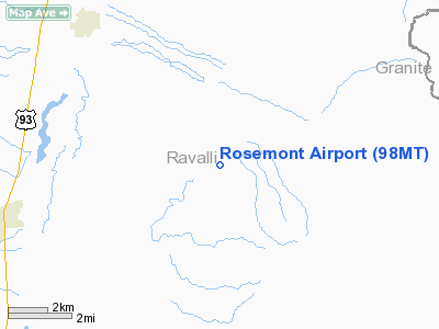
Location & QuickFacts
| FAA Information Effective: | 2008-09-25 |
| Airport Identifier: | 98MT |
| Airport Status: | Operational |
| Longitude/Latitude: | 114-00-11.4600W/46-26-34.1300N
-114.003183/46.442814 (Estimated) |
| Elevation: | 4172 ft / 1271.63 m (Estimated) |
| Land: | 160 acres |
| From nearest city: | 4 nautical miles SE of Stevensville, MT |
| Location: | Ravalli County, MT |
| Magnetic Variation: | () |
Owner & Manager
| Ownership: | Privately owned |
| Owner: | Zackery Jay Bugli |
| Address: | 2849 Mcintyre Rd
Stephensville, MT 59870 |
| Phone number: | 406-777-2563 |
| Manager: | Zackery Jay Bugli |
| Address: | 2849 Mcintyre Rd
Stephensville, MT 59870 |
| Phone number: | 406-777-0144 |
Airport Operations and Facilities
| Airport Use: | Private |
| Wind indicator: | Yes |
| Control Tower: | No |
| Sectional chart: | Great Falls |
| Region: | ANM - Northwest Mountain |
| Boundary ARTCC: | ZLC - Salt Lake City |
| Tie-in FSS: | GTF - Great Falls |
| FSS Toll Free: | 1-800-WX-BRIEF |
Runway Information
Runway 18/36
| Dimension: | 2500 x 40 ft / 762.0 x 12.2 m |
| Surface: | TURF, |
| |
Runway 18 |
Runway 36 |
| Traffic Pattern: | Left | Left |
| Obstruction: | 6 ft fence, 20.0 ft from runway | 6 ft fence, 20.0 ft from runway |
|
Radio Navigation Aids
| ID |
Type |
Name |
Ch |
Freq |
Var |
Dist |
| HMM | NDB | Hamilton | | 410.00 | 19E | 12.4 nm |
| INE | NDB | Konna | | 521.00 | 17E | 42.4 nm |
| DRU | VOR | Drummond | | 117.10 | 17E | 35.7 nm |
| MSO | VOR/DME | Missoula | 075X | 112.80 | 17E | 28.2 nm |
Remarks
Images and information placed above are from
http://www.airport-data.com/airport/98MT/
We thank them for the data!
We don't guarantee the information is fresh and accurate. The data may
be wrong or outdated.
For more up-to-date information please refer to other sources.
|
|


