 |
|
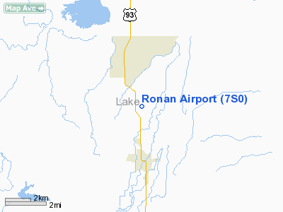
Location & QuickFacts
| FAA Information Effective: | 2008-09-25 |
| Airport Identifier: | 7S0 |
| Airport Status: | Operational |
| Longitude/Latitude: | 114-06-03.8600W/47-34-01.8220N
-114.101072/47.567173 (Estimated) |
| Elevation: | 3086 ft / 940.61 m (Surveyed) |
| Land: | 125 acres |
| From nearest city: | 3 nautical miles N of Ronan, MT |
| Location: | Lake County, MT |
| Magnetic Variation: | 18E (1985) |
Owner & Manager
| Ownership: | Publicly owned |
| Owner: | City Of Ronan And Lake Co |
| Address: |
Polson, MT 59860 |
| Phone number: | 406-883-6211 |
| Manager: | Vince Jennison |
| Address: | 3376 Bisson Ln, Box 559
Polson, MT 59860 |
| Phone number: | 406-883-2482 |
Airport Operations and Facilities
| Airport Use: | Open to public |
| Wind indicator: | Yes |
| Segmented Circle: | Yes |
| Control Tower: | No |
| Lighting Schedule: | DUSK-DAWN
MIRL RY 16/34 & PAPI RY 34 OPER 1600-2100, AFTER 2100 ACTVT MIRL RY 16/34 & PAPI RYS 16 & 34 - CTAF. |
| Beacon Color: | Clear-Green (lighted land airport) |
| Landing fee charge: | No |
| Sectional chart: | Great Falls |
| Region: | ANM - Northwest Mountain |
| Boundary ARTCC: | ZLC - Salt Lake City |
| Tie-in FSS: | GTF - Great Falls |
| FSS on Airport: | No |
| FSS Toll Free: | 1-800-WX-BRIEF |
| NOTAMs Facility: | GTF (NOTAM-d service avaliable) |
| Federal Agreements: | NGY |
Airport Communications
| CTAF: | 122.800 |
| Unicom: | 122.800 |
Airport Services
| Fuel available: | 100LLA
FUEL AVBL 24 HRS VIA SELF SERVE CREDIT CARD SVC. |
| Airframe Repair: | MINOR |
| Power Plant Repair: | MINOR |
| Bottled Oxygen: | NONE |
| Bulk Oxygen: | NONE |
Runway Information
Runway 16/34
| Dimension: | 4800 x 75 ft / 1463.0 x 22.9 m |
| Surface: | ASPH, Good Condition |
| Edge Lights: | Medium |
| |
Runway 16 |
Runway 34 |
| Longitude: | 114-06-03.8810W | 114-06-03.8400W |
| Latitude: | 47-34-25.5070N | 47-33-38.1370N |
| Elevation: | 3086.00 ft | 3079.00 ft |
| Alignment: | 127 | 127 |
| Traffic Pattern: | Left | Left |
| Markings: | Basic, Good Condition | Basic, Good Condition |
| Crossing Height: | 21.00 ft | 22.00 ft |
| VASI: | 2-light PAPI on left side | 2-light PAPI on left side |
| Visual Glide Angle: | 3.00° | 3.00° |
| Obstruction: | 15 ft road, 1125.0 ft from runway, 50:1 slope to clear | , 50:1 slope to clear |
|
Radio Navigation Aids
| ID |
Type |
Name |
Ch |
Freq |
Var |
Dist |
| PLS | NDB | Polson | | 275.00 | 20E | 8.5 nm |
| INE | NDB | Konna | | 521.00 | 17E | 30.9 nm |
| SAK | NDB | Smith Lake | | 515.00 | 18E | 35.6 nm |
| FCA | VOR/DME | Kalispell | 079X | 113.20 | 18E | 39.0 nm |
| MSO | VOR/DME | Missoula | 075X | 112.80 | 17E | 39.6 nm |
Remarks
- LARGE SEAGULLS ON & INVOF RY.
- TAXIWAY REFLECTORS.
Images and information placed above are from
http://www.airport-data.com/airport/7S0/
We thank them for the data!
| General Info
|
| Country |
United States
|
| State |
MONTANA
|
| FAA ID |
7S0
|
| Latitude |
47-34-01.822N
|
| Longitude |
114-06-03.860W
|
| Elevation |
3086 feet
|
| Near City |
RONAN
|
We don't guarantee the information is fresh and accurate. The data may
be wrong or outdated.
For more up-to-date information please refer to other sources.
|
|


