 |
|
Location & QuickFacts
| FAA Information Effective: | 2008-09-25 |
| Airport Identifier: | RC0 |
| Airport Status: | Operational |
| Longitude/Latitude: | 113-39-27.3360W/46-43-37.7370N
-113.657593/46.727149 (Estimated) |
| Elevation: | 3547 ft / 1081.13 m (Estimated) |
| Land: | 31 acres |
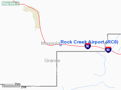
| From nearest city: | 3 nautical miles SE of Clinton, MT |
| Location: | Missoula County, MT |
| Magnetic Variation: | 18E (1985) |
Owner & Manager
| Ownership: | Publicly owned |
| Owner: | Montana Aeronautics Division |
| Address: | Po Box 200507
Helena, MT 59620-0507 |
| Phone number: | 406-444-2506 |
| Manager: | Montana Aeronautics Division |
| Address: | Po Box 200507
Helena, MT 59620-0507 |
| Phone number: | 406-444-2506 |
Airport Operations and Facilities
| Airport Use: | Open to public |
| Wind indicator: | Yes |
| Segmented Circle: | No |
| Control Tower: | No |
| Landing fee charge: | No |
| Sectional chart: | Great Falls |
| Region: | ANM - Northwest Mountain |
| Boundary ARTCC: | ZLC - Salt Lake City |
| Tie-in FSS: | GTF - Great Falls |
| FSS on Airport: | No |
| FSS Toll Free: | 1-800-WX-BRIEF |
| NOTAMs Facility: | GTF (NOTAM-d service avaliable) |
Airport Communications
Airport Services
| Airframe Repair: | NONE |
| Power Plant Repair: | NONE |
| Bottled Oxygen: | NONE |
| Bulk Oxygen: | NONE |
Runway Information
Runway 07/25
| Dimension: | 4100 x 75 ft / 1249.7 x 22.9 m |
| Surface: | TURF, Fair Condition
GOPHER HOLES FULL RY LENGTH. |
| |
Runway 07 |
Runway 25 |
| Traffic Pattern: | Right | Right |
| Markings: | Nonstandard,
RY 07/25 RED CONES AT THLDS. | Nonstandard, |
| Obstruction: | 700 ft hill, 2100.0 ft from runway, 335 ft left of centerline, 3:1 slope to clear
RY 07 +55 FT SIGN ON RY CNTRLN EXTDD 915 FT FM THLD. +44 FT SIGN ON RY CNTRLN EXTDD 800 FT FM THLD. | 38 ft trees, 75.0 ft from runway, 84 ft left of centerline, 2:1 slope to clear |
|
Radio Navigation Aids
| ID |
Type |
Name |
Ch |
Freq |
Var |
Dist |
| HMM | NDB | Hamilton | | 410.00 | 19E | 34.5 nm |
| INE | NDB | Konna | | 521.00 | 17E | 37.5 nm |
| DRU | VOR | Drummond | | 117.10 | 17E | 20.2 nm |
| MSO | VOR/DME | Missoula | 075X | 112.80 | 17E | 20.6 nm |
Remarks
- SNOW REMOVAL IRREGULAR.
- PLINE CROSSING 1.3 NM S OF ARPT (605 FT AGL) 4152 FT MSL.
- TREES & TRRN IN TRANSITION SFC BOTH SIDES OF RY.
- EST PRIOR TO 1959.
Images and information placed above are from
http://www.airport-data.com/airport/RC0/
We thank them for the data!
We don't guarantee the information is fresh and accurate. The data may
be wrong or outdated.
For more up-to-date information please refer to other sources.
|
|


