 |
|
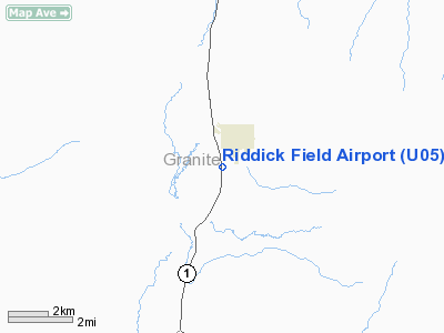
Location & QuickFacts
| FAA Information Effective: | 2008-09-25 |
| Airport Identifier: | U05 |
| Airport Status: | Operational |
| Longitude/Latitude: | 113-18-18.2310W/46-19-09.7310N
-113.305064/46.319370 (Estimated) |
| Elevation: | 5212 ft / 1588.62 m (Surveyed) |
| Land: | 44 acres |
| From nearest city: | 1 nautical miles SE of Philipsburg, MT |
| Location: | Granite County, MT |
| Magnetic Variation: | 17E (1985) |
Owner & Manager
| Ownership: | Publicly owned |
| Owner: | Granite County |
| Address: | County Courthouse
Philipsburg, MT 59858 |
| Phone number: | 406-859-3771
406-544-3733 (CELL) |
| Manager: | Dean Neitz |
| Address: | P.o. Box 446
Philipsburg, MT 59858 |
| Phone number: | 406-859-3608
406-544-3733 (CELL) |
Airport Operations and Facilities
| Airport Use: | Open to public |
| Wind indicator: | Yes |
| Segmented Circle: | Yes |
| Control Tower: | No |
| Lighting Schedule: | DUSK-DAWN
ACTVT MIRL RY 16/34 - CTAF. |
| Beacon Color: | Clear-Green (lighted land airport) |
| Landing fee charge: | No |
| Sectional chart: | Great Falls |
| Region: | ANM - Northwest Mountain |
| Boundary ARTCC: | ZLC - Salt Lake City |
| Tie-in FSS: | GTF - Great Falls |
| FSS on Airport: | No |
| FSS Toll Free: | 1-800-WX-BRIEF |
| NOTAMs Facility: | GTF (NOTAM-d service avaliable) |
| Federal Agreements: | NGY |
Airport Communications
Airport Services
| Airframe Repair: | NONE |
| Power Plant Repair: | NONE |
| Bottled Oxygen: | NONE |
| Bulk Oxygen: | NONE |
Runway Information
Runway 16/34
| Dimension: | 3600 x 60 ft / 1097.3 x 18.3 m |
| Surface: | ASPH, Poor Condition
PAVEMENT IS SPALLING, MAJOR CRACK PROPIGATION THROUGHOUT. MULTIPLE EDGE FRACTURES. |
| Weight Limit: | Single wheel: 7000 lbs. |
| Edge Lights: | Medium |
| |
Runway 16 |
Runway 34 |
| Traffic Pattern: | Right | Left |
| Markings: | Numbers only, Poor Condition
RWY MARKINGS COMPLETELY FADED | Numbers only, Poor Condition
RWY MARKINGS COMPLETELY FADED |
| Obstruction: | 18 ft road, 596.0 ft from runway, 22:1 slope to clear | 263 ft hill, 4400.0 ft from runway, 545 ft right of centerline, 15:1 slope to clear |
|
Radio Navigation Aids
| ID |
Type |
Name |
Ch |
Freq |
Var |
Dist |
| HMM | NDB | Hamilton | | 410.00 | 19E | 34.6 nm |
| DRU | VOR | Drummond | | 117.10 | 17E | 19.7 nm |
| CPN | VOR/DME | Coppertown | 053X | 111.60 | 16E | 28.9 nm |
| MSO | VOR/DME | Missoula | 075X | 112.80 | 17E | 47.8 nm |
Images and information placed above are from
http://www.airport-data.com/airport/U05/
We thank them for the data!
| General Info
|
| Country |
United States
|
| State |
MONTANA
|
| FAA ID |
U05
|
| Latitude |
46-19-09.731N
|
| Longitude |
113-18-18.231W
|
| Elevation |
5212 feet
|
| Near City |
PHILIPSBURG
|
We don't guarantee the information is fresh and accurate. The data may
be wrong or outdated.
For more up-to-date information please refer to other sources.
|
|


