 |
|
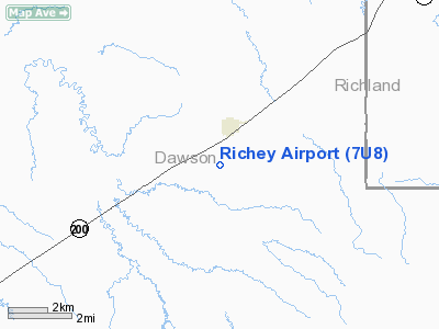
Location & QuickFacts
| FAA Information Effective: | 2008-09-25 |
| Airport Identifier: | 7U8 |
| Airport Status: | Operational |
| Longitude/Latitude: | 105-04-34.9130W/47-37-36.0520N
-105.076365/47.626681 (Estimated) |
| Elevation: | 2493 ft / 759.87 m (Surveyed) |
| Land: | 39 acres |
| From nearest city: | 1 nautical miles SW of Richey, MT |
| Location: | Dawson County, MT |
| Magnetic Variation: | 13E (1985) |
Owner & Manager
| Ownership: | Publicly owned |
| Owner: | Montana Aeronautics Division |
| Address: | Po Box 200507
Helena, MT 59620-0507 |
| Phone number: | 406-444-2506 |
| Manager: | Nils Sikveland |
| Address: | Box 254
Richey, MT 59259 |
| Phone number: | 406-773-5835 |
Airport Operations and Facilities
| Airport Use: | Open to public |
| Wind indicator: | Yes |
| Segmented Circle: | Yes |
| Control Tower: | No |
| Lighting Schedule: | DUSK-DAWN
ACTVT LIRL RY 14/32 - CTAF. |
| Beacon Color: | Clear-Green (lighted land airport) |
| Landing fee charge: | No |
| Sectional chart: | Billings |
| Region: | ANM - Northwest Mountain |
| Boundary ARTCC: | ZLC - Salt Lake City |
| Tie-in FSS: | GTF - Great Falls |
| FSS on Airport: | No |
| FSS Toll Free: | 1-800-WX-BRIEF |
| NOTAMs Facility: | GTF (NOTAM-d service avaliable) |
Airport Communications
Airport Services
| Airframe Repair: | NONE |
| Power Plant Repair: | NONE |
| Bottled Oxygen: | NONE |
| Bulk Oxygen: | NONE |
Runway Information
Runway 14/32
| Dimension: | 2690 x 75 ft / 819.9 x 22.9 m |
| Surface: | TURF-DIRT, Good Condition
CENTER 20 FT OF RY - SOFT GRADED DIRT - PERIMETER IS TURF. |
| Edge Lights: | Low |
| |
Runway 14 |
Runway 32 |
| Traffic Pattern: | Left | Left |
| Obstruction: | , 50:1 slope to clear | 82 ft hill, 1650.0 ft from runway, 20:1 slope to clear |
|
Radio Navigation Aids
| ID |
Type |
Name |
Ch |
Freq |
Var |
Dist |
| CRR | NDB | Circle | | 245.00 | 15E | 23.2 nm |
| GDV | NDB | Glendive | | 410.00 | 13E | 31.6 nm |
| OLF | NDB | Wolf Point | | 404.00 | 11E | 35.7 nm |
| SDY | NDB | Sidney | | 359.00 | 12E | 36.6 nm |
Remarks
Images and information placed above are from
http://www.airport-data.com/airport/7U8/
We thank them for the data!
| General Info
|
| Country |
United States
|
| State |
MONTANA
|
| FAA ID |
7U8
|
| Latitude |
47-37-36.052N
|
| Longitude |
105-04-34.913W
|
| Elevation |
2493 feet
|
| Near City |
RICHEY
|
We don't guarantee the information is fresh and accurate. The data may
be wrong or outdated.
For more up-to-date information please refer to other sources.
|
|


