 |
|
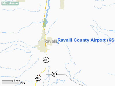
Location & QuickFacts
| FAA Information Effective: | 2008-09-25 |
| Airport Identifier: | 6S5 |
| Airport Status: | Operational |
| Longitude/Latitude: | 114-07-31.9450W/46-15-05.3800N
-114.125540/46.251494 (Estimated) |
| Elevation: | 3642 ft / 1110.08 m (Surveyed) |
| Land: | 156 acres |
| From nearest city: | 1 nautical miles E of Hamilton, MT |
| Location: | Ravalli County, MT |
| Magnetic Variation: | 18E (1985) |
Owner & Manager
| Ownership: | Publicly owned |
| Owner: | Ravalli Co |
| Address: | Courthouse Box 5016, Suite A
Hamilton, MT 59840 |
| Phone number: | 406-369-0183 |
| Manager: | Page Gough |
| Address: | 215 S. 4th Street Suite A
Hamilton, MT 59840 |
| Phone number: | 406-375-9149 |
Airport Operations and Facilities
| Airport Use: | Open to public |
| Wind indicator: | Yes |
| Segmented Circle: | Yes |
| Control Tower: | No |
| Lighting Schedule: | DUSK-DAWN
ACTVT MIRL RY 16/34 & PAPI RY 16 & 34 - CTAF. FOR MIRL RY 16/34 DURG DALGHT HRS CTC AMGR 406-375-5473. |
| Beacon Color: | Clear-Green (lighted land airport) |
| Landing fee charge: | No |
| Sectional chart: | Great Falls |
| Region: | ANM - Northwest Mountain |
| Traffic Pattern Alt: | 800 ft |
| Boundary ARTCC: | ZLC - Salt Lake City |
| Tie-in FSS: | GTF - Great Falls |
| FSS on Airport: | No |
| FSS Toll Free: | 1-800-WX-BRIEF |
| NOTAMs Facility: | GTF (NOTAM-d service avaliable) |
| Federal Agreements: | NGY |
Airport Communications
| CTAF: | 122.800 |
| Unicom: | 122.800 |
Airport Services
| Fuel available: | 100LLA |
| Airframe Repair: | MAJOR |
| Power Plant Repair: | MAJOR |
Runway Information
Runway 16/34
| Dimension: | 4200 x 75 ft / 1280.2 x 22.9 m |
| Surface: | ASPH, Fair Condition |
| Surface Treatment: | Porous Friction Course |
| Weight Limit: | Single wheel: 17000 lbs.
Dual wheel: 25000 lbs. |
| Edge Lights: | Medium |
| |
Runway 16 |
Runway 34 |
| Longitude: | 114-07-31.5600W | 114-07-32.3300W |
| Latitude: | 46-15-26.1000N | 46-14-44.6600N |
| Elevation: | 3603.00 ft | 3641.00 ft |
| Alignment: | 127 | 1 |
| Traffic Pattern: | Left | Left |
| Markings: | Basic, Poor Condition
RY 16/34 MKGS FADED. | Basic, Poor Condition |
| Crossing Height: | 35.00 ft | 25.00 ft |
| VASI: | 2-light PAPI on left side | 2-light PAPI on left side |
| Visual Glide Angle: | 3.00° | 3.30° |
| Obstruction: | 114 ft trees, 1044.0 ft from runway, 258 ft left of centerline, 7:1 slope to clear
+30' HILL ON CNTRLN EXTDD.
-4 FT DITCH 122 FT L 0 FT TO 200 FT FM END OF RY. | 70 ft trees, 764.0 ft from runway, 400 ft right of centerline, 8:1 slope to clear
+60' TREES 50' LEFT OF CNTRLN EXTDD. |
|
Radio Navigation Aids
| ID |
Type |
Name |
Ch |
Freq |
Var |
Dist |
| HMM | NDB | Hamilton | | 410.00 | 19E | 0.5 nm |
| DRU | VOR | Drummond | | 117.10 | 17E | 45.2 nm |
| MSO | VOR/DME | Missoula | 075X | 112.80 | 17E | 39.5 nm |
Remarks
- LOOSE ASPH MATERIAL ON PARALLEL TWY FOR RY 16/34.
Images and information placed above are from
http://www.airport-data.com/airport/6S5/
We thank them for the data!
| General Info
|
| Country |
United States
|
| State |
MONTANA
|
| FAA ID |
6S5
|
| Latitude |
46-15-05.380N
|
| Longitude |
114-07-31.945W
|
| Elevation |
3642 feet
|
| Near City |
HAMILTON
|
We don't guarantee the information is fresh and accurate. The data may
be wrong or outdated.
For more up-to-date information please refer to other sources.
|
|


