 |
|
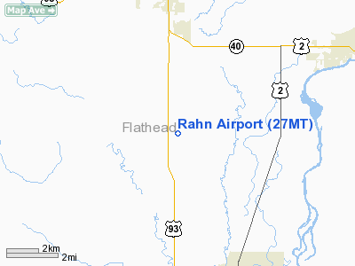
Location & QuickFacts
| FAA Information Effective: | 2008-09-25 |
| Airport Identifier: | 27MT |
| Airport Status: | Operational |
| Longitude/Latitude: | 114-19-38.9000W/48-19-18.9000N
-114.327472/48.321917 (Estimated) |
| Elevation: | 3090 ft / 941.83 m (Estimated) |
| Land: | 14 acres |
| From nearest city: | 9 nautical miles N of Kalispell, MT |
| Location: | Flathead County, MT |
| Magnetic Variation: | () |
Owner & Manager
| Ownership: | Privately owned |
| Owner: | Robert K. & Teri E. Rahn |
| Address: | 400 Bowdish Road
Kalispell, MT 59901 |
| Phone number: | 406-755-7246 |
| Manager: | Robert K Rahn |
| Address: | 400 Bowdish Road
Kalispell, MT 59901 |
| Phone number: | 406-755-7246 |
Airport Operations and Facilities
| Airport Use: | Private |
| Wind indicator: | Yes |
| Control Tower: | No |
| Sectional chart: | Great Falls |
| Region: | ANM - Northwest Mountain |
| Boundary ARTCC: | ZLC - Salt Lake City |
| Tie-in FSS: | GTF - Great Falls |
| FSS Toll Free: | 1-800-WX-BRIEF |
Runway Information
Runway 16/34
| Dimension: | 1000 x 100 ft / 304.8 x 30.5 m |
| Surface: | TURF, |
| |
Runway 16 |
Runway 34 |
| Traffic Pattern: | Left | Left |
| Obstruction: | 4 ft fence, 10.0 ft from runway | 60 ft trees, 20.0 ft from runway |
|
Radio Navigation Aids
| ID |
Type |
Name |
Ch |
Freq |
Var |
Dist |
| SAK | NDB | Smith Lake | | 515.00 | 18E | 13.9 nm |
| PLS | NDB | Polson | | 275.00 | 20E | 38.1 nm |
| LYI | NDB | Libby | | 414.00 | 17E | 46.7 nm |
| EUR | NDB | Eureka | | 392.00 | 20E | 49.1 nm |
| FCA | VOR/DME | Kalispell | 079X | 113.20 | 18E | 8.9 nm |
Remarks
- PRVDD OPNS COORDINATED W/GLACIER PARK INTL ARPT ATCT; PROPONENT COMPLIES WITH CLASS "D" AIRSPACE REQUIREMENTS.
Images and information placed above are from
http://www.airport-data.com/airport/27MT/
We thank them for the data!
We don't guarantee the information is fresh and accurate. The data may
be wrong or outdated.
For more up-to-date information please refer to other sources.
|
|


