 |
|
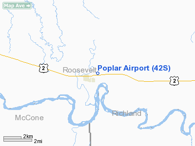
Location & QuickFacts
| FAA Information Effective: | 2008-09-25 |
| Airport Identifier: | 42S |
| Airport Status: | Operational |
| Longitude/Latitude: | 105-10-55.8940W/48-06-57.4510N
-105.182193/48.115959 (Estimated) |
| Elevation: | 2005 ft / 611.12 m (Surveyed) |
| Land: | 69 acres |
| From nearest city: | 0 nautical miles NE of Poplar, MT |
| Location: | Roosevelt County, MT |
| Magnetic Variation: | 12E (2000) |
Owner & Manager
| Ownership: | Publicly owned |
| Owner: | Poplar City Roosevelt Co
LAND LEASED FROM FT PECK INDIAN TRIBE. |
| Address: | Box 630 City Of Poplar
Poplar, MT 59255 |
| Phone number: | 406-768-3483 |
| Manager: | Dallas O'connor |
| Address: | Box 128
Poplar, MT 59255 |
| Phone number: | 406-768-3800 |
Airport Operations and Facilities
| Airport Use: | Open to public |
| Wind indicator: | Yes |
| Segmented Circle: | Yes |
| Control Tower: | No |
| Lighting Schedule: | DUSK-DAWN
ACTVT MIRL 09/27 & VASI RY 27 - CTAF. |
| Beacon Color: | Clear-Green (lighted land airport) |
| Landing fee charge: | No |
| Sectional chart: | Billings |
| Region: | ANM - Northwest Mountain |
| Boundary ARTCC: | ZLC - Salt Lake City |
| Tie-in FSS: | GTF - Great Falls |
| FSS on Airport: | No |
| FSS Toll Free: | 1-800-WX-BRIEF |
| NOTAMs Facility: | GTF (NOTAM-d service avaliable) |
| Federal Agreements: | NGY |
Airport Communications
| CTAF: | 122.800 |
| Unicom: | 122.800 |
Airport Services
| Fuel available: | 100LL |
| Airframe Repair: | MINOR |
| Power Plant Repair: | MINOR |
| Bottled Oxygen: | HIGH |
| Bulk Oxygen: | HIGH |
Runway Information
Runway 09/27
| Dimension: | 3030 x 60 ft / 923.5 x 18.3 m |
| Surface: | ASPH, Poor Condition
RWY IS ROUGH, WITH DEBRIS. |
| Surface Treatment: | Porous Friction Course |
| Weight Limit: | Single wheel: 4000 lbs. |
| Edge Lights: | Medium |
| |
Runway 09 |
Runway 27 |
| Longitude: | 105-11-17.5080W | 105-10-34.2790W |
| Latitude: | 48-07-01.2030N | 48-06-53.6980N |
| Elevation: | 2004.00 ft | 2002.00 ft |
| Alignment: | 105 | 127 |
| Traffic Pattern: | Left | Left |
| Markings: | Basic, Poor Condition
RWY MARKINGS FADED | Basic, Poor Condition
MARKINGS FADED |
| Crossing Height: | 0.00 ft | 21.00 ft |
| VASI: | | 2-box on left side |
| Visual Glide Angle: | 0.00° | 3.00° |
| Obstruction: | , 50:1 slope to clear | 25 ft pole, 1031.0 ft from runway, 33:1 slope to clear |
|
Radio Navigation Aids
| ID |
Type |
Name |
Ch |
Freq |
Var |
Dist |
| OLF | NDB | Wolf Point | | 404.00 | 11E | 16.9 nm |
| SCO | NDB | Scobey | | 283.00 | 16E | 42.8 nm |
| CRR | NDB | Circle | | 245.00 | 15E | 44.6 nm |
| SDY | NDB | Sidney | | 359.00 | 12E | 47.1 nm |
| PWD | NDB | Plentywood | | 251.00 | 16E | 48.2 nm |
Images and information placed above are from
http://www.airport-data.com/airport/42S/
We thank them for the data!
| General Info
|
| Country |
United States
|
| State |
MONTANA
|
| FAA ID |
42S
|
| Latitude |
48-06-57.451N
|
| Longitude |
105-10-55.894W
|
| Elevation |
2005 feet
|
| Near City |
POPLAR
|
We don't guarantee the information is fresh and accurate. The data may
be wrong or outdated.
For more up-to-date information please refer to other sources.
|
|


