 |
|
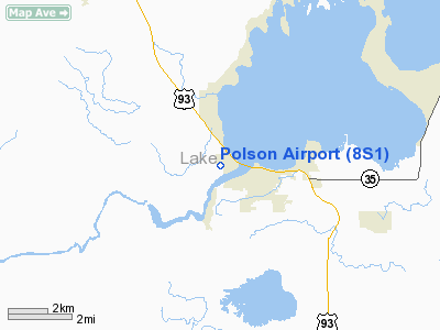
Location & QuickFacts
| FAA Information Effective: | 2008-09-25 |
| Airport Identifier: | 8S1 |
| Airport Status: | Operational |
| Longitude/Latitude: | 114-11-07.0310W/47-41-43.5950N
-114.185286/47.695443 (Estimated) |
| Elevation: | 2941 ft / 896.42 m (Surveyed) |
| Land: | 97 acres |
| From nearest city: | 1 nautical miles W of Polson, MT |
| Location: | Lake County, MT |
| Magnetic Variation: | 17E (2000) |
Owner & Manager
| Ownership: | Publicly owned |
| Owner: | City Of Polson & Lake Co. |
| Address: | 106 4th Ave E
Polson, MT 59860 |
| Phone number: | 406-883-7214 |
| Manager: | Vince Jennison |
| Address: | 3376 Bisson Ln
Polson, MT 59860 |
| Phone number: | 406-883-2482 |
Airport Operations and Facilities
| Airport Use: | Open to public |
| Wind indicator: | Yes |
| Segmented Circle: | Yes |
| Control Tower: | No |
| Lighting Schedule: | DUSK-DAWN
ACTVT MIRL RY 18/36, PAPI RYS 18 & 36 - CTAF. |
| Beacon Color: | Clear-Green (lighted land airport) |
| Landing fee charge: | No |
| Sectional chart: | Great Falls |
| Region: | ANM - Northwest Mountain |
| Boundary ARTCC: | ZLC - Salt Lake City |
| Tie-in FSS: | GTF - Great Falls |
| FSS on Airport: | No |
| FSS Toll Free: | 1-800-WX-BRIEF |
| NOTAMs Facility: | GTF (NOTAM-d service avaliable) |
| Federal Agreements: | NGY |
Airport Communications
| CTAF: | 122.800 |
| Unicom: | 122.800 |
Airport Services
| Fuel available: | 100LLA
24 HR. SELF SERVICE FUEL AVAILIBLE. |
| Airframe Repair: | MAJOR |
| Power Plant Repair: | MAJOR |
| Bottled Oxygen: | NONE |
| Bulk Oxygen: | NONE |
Runway Information
Runway 03W/21W
| Dimension: | 4000 x 500 ft / 1219.2 x 152.4 m |
| Surface: | WATER, |
| |
Runway 03W |
Runway 21W |
| Traffic Pattern: | Left | Left |
|
Runway 18/36
| Dimension: | 4195 x 75 ft / 1278.6 x 22.9 m |
| Surface: | ASPH, Good Condition |
| Weight Limit: | Single wheel: 17000 lbs. |
| Edge Lights: | Medium |
| |
Runway 18 |
Runway 36 |
| Longitude: | 114-10-57.2830W | 114-11-16.7800W |
| Latitude: | 47-42-03.2190N | 47-41-23.9710N |
| Elevation: | 2937.00 ft | 2939.00 ft |
| Alignment: | 127 | 19 |
| Traffic Pattern: | Left | Left |
| Markings: | Basic, Good Condition | Basic, Good Condition |
| Crossing Height: | 28.00 ft | 31.00 ft |
| VASI: | 4-light PAPI on left side | 2-light PAPI on left side |
| Visual Glide Angle: | 3.00° | 4.00° |
| Obstruction: | 17 ft hwy, 537.0 ft from runway, 19:1 slope to clear | 8 ft hill, 377.0 ft from runway, 22:1 slope to clear
-10 FT DITCH 168 FT FM RY END CROSSING RY CNTRLN DROPPING OFF TO -60 FT 60 FT R. |
|
Radio Navigation Aids
| ID |
Type |
Name |
Ch |
Freq |
Var |
Dist |
| PLS | NDB | Polson | | 275.00 | 20E | 0.1 nm |
| SAK | NDB | Smith Lake | | 515.00 | 18E | 27.2 nm |
| INE | NDB | Konna | | 521.00 | 17E | 37.1 nm |
| FCA | VOR/DME | Kalispell | 079X | 113.20 | 18E | 31.2 nm |
| MSO | VOR/DME | Missoula | 075X | 112.80 | 17E | 47.5 nm |
Remarks
- TOWER 600 FT AGL 3 MI S UNLGTD.
- WHEN LNDG ON RY 36 BE ALERT TO SEAPLANE LNDGS ON ADJ RIVER.
- +405 FT RIDGE 8500 FT FM RY 36 END.
- SEAPLANE LNDG AREA ALSO USED BY BOATS.
Images and information placed above are from
http://www.airport-data.com/airport/8S1/
We thank them for the data!
| General Info
|
| Country |
United States
|
| State |
MONTANA
|
| FAA ID |
8S1
|
| Latitude |
47-41-43.595N
|
| Longitude |
114-11-07.031W
|
| Elevation |
2941 feet
|
| Near City |
POLSON
|
We don't guarantee the information is fresh and accurate. The data may
be wrong or outdated.
For more up-to-date information please refer to other sources.
|
|


