 |
|
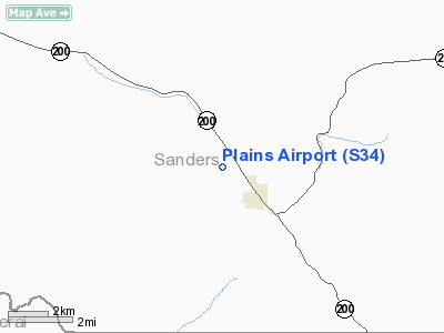
Location & QuickFacts
| FAA Information Effective: | 2008-09-25 |
| Airport Identifier: | S34 |
| Airport Status: | Operational |
| Longitude/Latitude: | 114-54-25.5000W/47-28-24.8000N
-114.907083/47.473556 (Estimated) |
| Elevation: | 2467 ft / 751.94 m (Estimated) |
| Land: | 259 acres |
| From nearest city: | 1 nautical miles NW of Plains, MT |
| Location: | Sanders County, MT |
| Magnetic Variation: | 18E (1985) |
Owner & Manager
| Ownership: | Publicly owned |
| Owner: | Sanders County |
| Address: | Po Box 519
Thompson Falls, MT 59873 |
| Phone number: | 406-827-6942 |
| Manager: | Randy Garrison |
| Address: | Po Box 988
Plains, MT 59859 |
| Phone number: | 406-826-3605 |
Airport Operations and Facilities
| Airport Use: | Open to public |
| Wind indicator: | Yes |
| Segmented Circle: | Yes |
| Control Tower: | No |
| Lighting Schedule: | DUSK-DAWN
ACTVT MIRL RY 13/31 & PAPI RY 31 - CTAF. |
| Beacon Color: | Clear-Green (lighted land airport) |
| Landing fee charge: | No |
| Sectional chart: | Great Falls |
| Region: | ANM - Northwest Mountain |
| Boundary ARTCC: | ZLC - Salt Lake City |
| Tie-in FSS: | GTF - Great Falls |
| FSS on Airport: | No |
| FSS Toll Free: | 1-800-WX-BRIEF |
| NOTAMs Facility: | GTF (NOTAM-d service avaliable) |
| Federal Agreements: | N |
Airport Communications
Airport Services
| Airframe Repair: | NONE |
| Power Plant Repair: | NONE |
| Bottled Oxygen: | NONE |
| Bulk Oxygen: | NONE |
Runway Information
Runway 13/31
| Dimension: | 4650 x 75 ft / 1417.3 x 22.9 m |
| Surface: | ASPH, Good Condition |
| Weight Limit: | Single wheel: 12500 lbs.
Dual wheel: 18000 lbs. |
| Edge Lights: | Medium |
| |
Runway 13 |
Runway 31 |
| Traffic Pattern: | Left | Left |
| Markings: | Basic, Good Condition | Basic, Good Condition |
| Crossing Height: | 0.00 ft | 20.00 ft |
| VASI: | | 2-light PAPI on left side |
| Visual Glide Angle: | 0.00° | 3.00° |
| Obstruction: | 11 ft road, 969.0 ft from runway, 204 ft left of centerline, 28:1 slope to clear | , 50:1 slope to clear |
|
Radio Navigation Aids
| ID |
Type |
Name |
Ch |
Freq |
Var |
Dist |
| INE | NDB | Konna | | 521.00 | 17E | 30.9 nm |
| PLS | NDB | Polson | | 275.00 | 20E | 32.1 nm |
| SAK | NDB | Smith Lake | | 515.00 | 18E | 42.2 nm |
| MLP | VOR/DME | Mullan Pass | 125X | 117.80 | 20E | 30.0 nm |
| MSO | VOR/DME | Missoula | 075X | 112.80 | 17E | 47.8 nm |
Remarks
Images and information placed above are from
http://www.airport-data.com/airport/S34/
We thank them for the data!
| General Info
|
| Country |
United States
|
| State |
MONTANA
|
| FAA ID |
S34
|
| Latitude |
47-28-20.770N
|
| Longitude |
114-54-00.486W
|
| Elevation |
2462 feet
|
| Near City |
PLAINS
|
We don't guarantee the information is fresh and accurate. The data may
be wrong or outdated.
For more up-to-date information please refer to other sources.
|
|


