 |
|
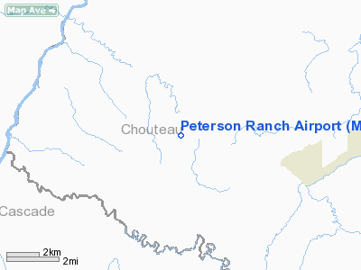
Location & QuickFacts
| FAA Information Effective: | 2008-09-25 |
| Airport Identifier: | MT77 |
| Airport Status: | Operational |
| Longitude/Latitude: | 110-54-19.8340W/47-36-29.8830N
-110.905509/47.608301 (Estimated) |
| Elevation: | 3340 ft / 1018.03 m (Estimated) |
| Land: | 93 acres |
| From nearest city: | 5 nautical miles NW of Highwood, MT |
| Location: | Chouteau County, MT |
| Magnetic Variation: | 17E (1985) |
Owner & Manager
| Ownership: | Privately owned |
| Owner: | G.r. Peterson Ii |
| Address: | 2201 Sheperd Crossing
Highwood, MT 59450 |
| Manager: | G.r. Peterson Ii |
| Address: | 2201 Sheperd Crossing
Highwood, MT 59450 |
Airport Operations and Facilities
| Airport Use: | Private |
| Segmented Circle: | No |
| Control Tower: | No |
| Sectional chart: | Great Falls |
| Region: | ANM - Northwest Mountain |
| Boundary ARTCC: | ZLC - Salt Lake City |
| Tie-in FSS: | GTF - Great Falls |
| FSS Toll Free: | 1-800-WX-BRIEF |
Airport Services
Runway Information
Runway 05/23
| Dimension: | 2000 x 50 ft / 609.6 x 15.2 m |
| Surface: | TURF, |
| |
Runway 05 |
Runway 23 |
| Traffic Pattern: | Left | Left |
| Displaced threshold: | 500.00 ft | 0.00 ft |
| Obstruction: | 35 ft pline, 10.0 ft from runway | |
|
Runway 07S/25S
| Dimension: | 800 x 50 ft / 243.8 x 15.2 m |
| Surface: | TURF, |
| |
Runway 07S |
Runway 25S |
| Traffic Pattern: | Left | Left |
|
Runway 17/35
| Dimension: | 2040 x 50 ft / 621.8 x 15.2 m |
| Surface: | TURF, |
| |
Runway 17 |
Runway 35 |
| Traffic Pattern: | Left | Left |
| Obstruction: | | 10 ft pline, 150.0 ft from runway |
|
Radio Navigation Aids
| ID |
Type |
Name |
Ch |
Freq |
Var |
Dist |
| ITU | NDB | Truly | | 371.00 | 16E | 23.9 nm |
| GFA | TACAN | Malmstrom | 105X | | 17E | 12.8 nm |
| GTF | VORTAC | Great Falls | 098X | 115.10 | 16E | 22.7 nm |
Remarks
- PRVDD ARPT IS OPERATED IN ACCORDANCE WITH PROPONENTS PROPOSAL.
Images and information placed above are from
http://www.airport-data.com/airport/MT77/
We thank them for the data!
| General Info
|
| Country |
United States
|
| State |
MONTANA
|
| FAA ID |
MT77
|
| Latitude |
47-36-29.883N
|
| Longitude |
110-54-19.834W
|
| Elevation |
3340 feet
|
| Near City |
HIGHWOOD
|
We don't guarantee the information is fresh and accurate. The data may
be wrong or outdated.
For more up-to-date information please refer to other sources.
|
|


