 |
|
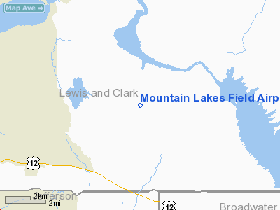
Mountain Lakes Field Airport |
Location & QuickFacts
| FAA Information Effective: | 2008-09-25 |
| Airport Identifier: | 5M7 |
| Airport Status: | Operational |
| Longitude/Latitude: | 111-48-23.9440W/46-37-50.7680N
-111.806651/46.630769 (Estimated) |
| Elevation: | 4250 ft / 1295.40 m (Estimated) |
| Land: | 0 acres |
| From nearest city: | 11 nautical miles NE of Helena, MT |
| Location: | Lewis And Clark County, MT |
| Magnetic Variation: | 16E (1990) |
Owner & Manager
| Ownership: | Privately owned |
| Owner: | Darrel & Robin Folkvord |
| Address: | 3557 Eames Lane
Helena, MT 59601 |
| Phone number: | 406-475-3528 |
| Manager: | Darrel Folkvore |
| Address: | 3557 Eames Lane
Helena, MT 59601 |
| Phone number: | 406-475-3528 |
Airport Operations and Facilities
| Airport Use: | Open to public |
| Wind indicator: | Yes |
| Segmented Circle: | No |
| Control Tower: | No |
| Sectional chart: | Great Falls |
| Region: | ANM - Northwest Mountain |
| Boundary ARTCC: | ZLC - Salt Lake City |
| Tie-in FSS: | GTF - Great Falls |
| FSS Toll Free: | 1-800-WX-BRIEF |
| NOTAMs Facility: | GTF (NOTAM-d service avaliable) |
Airport Communications
| CTAF: | 122.800 |
| Unicom: | 122.800 |
Runway Information
Runway 07/25
| Dimension: | 1570 x 60 ft / 478.5 x 18.3 m |
| Surface: | TURF, Good Condition |
| |
Runway 07 |
Runway 25 |
| Traffic Pattern: | Left | Left |
| Obstruction: | 30 ft pline, 145.0 ft from runway, 4:1 slope to clear | , 50:1 slope to clear |
|
Runway 17/35
| Dimension: | 2250 x 60 ft / 685.8 x 18.3 m |
| Surface: | TURF, Good Condition |
| |
Runway 17 |
Runway 35 |
| Traffic Pattern: | Left | Left |
|
Radio Navigation Aids
| ID |
Type |
Name |
Ch |
Freq |
Var |
Dist |
| HAU | NDB | Hauser | | 386.00 | 16E | 4.2 nm |
| CVP | NDB | Capitol | | 335.00 | 16E | 5.6 nm |
| ITU | NDB | Truly | | 371.00 | 16E | 47.6 nm |
| HLN | VORTAC | Helena | 124X | 117.70 | 16E | 6.2 nm |
| HIA | VORTAC | Whitehall | 084X | 113.70 | 18E | 48.6 nm |
Remarks
- IRRIGATION PIPES AND LIVESTOCK INVOF RYS.
- RY 07/25 HAS SHORT APCH EACH END RY DUE TO LENGTH AND POWERLINE OBSTRUCTION.
- RAPIDLY RISING MOUNTAINOUS TERRAIN AER 25.
- RYS 07/25 & 17/35 SOFT WHEN WET.
Images and information placed above are from
http://www.airport-data.com/airport/5M7/
We thank them for the data!
| General Info
|
| Country |
United States
|
| State |
MONTANA
|
| FAA ID |
5M7
|
| Latitude |
46-37-50.768N
|
| Longitude |
111-48-23.944W
|
| Elevation |
4250 feet
|
| Near City |
HELENA
|
We don't guarantee the information is fresh and accurate. The data may
be wrong or outdated.
For more up-to-date information please refer to other sources.
|
|


