 |
|
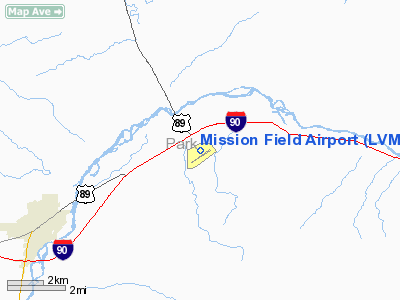
Location & QuickFacts
| FAA Information Effective: | 2008-09-25 |
| Airport Identifier: | LVM |
| Airport Status: | Operational |
| Longitude/Latitude: | 110-26-53.9000W/45-41-57.8000N
-110.448306/45.699389 (Estimated) |
| Elevation: | 4660 ft / 1420.37 m (Surveyed) |
| Land: | 689 acres |
| From nearest city: | 5 nautical miles E of Livingston, MT |
| Location: | Park County, MT |
| Magnetic Variation: | 15E (1990) |
Owner & Manager
| Ownership: | Publicly owned |
| Owner: | Livingston City Park Co |
| Address: | County Bldg, 414 E Calender
Livingston, MT 59047 |
| Phone number: | 406-222-6120 |
| Manager: | Russel Ferguson |
| Address: | 82 Airport Rd
Livingston, MT 59047 |
| Phone number: | 406-222-6504 |
Airport Operations and Facilities
| Airport Use: | Open to public |
| Wind indicator: | Yes |
| Segmented Circle: | No |
| Control Tower: | No |
| Lighting Schedule: | DUSK-DAWN
RY 04/22 MIRL OPER DUSK-2300; AFTER 2300 ACTVT MIRL RY 04/22 - 123.0. |
| Beacon Color: | Clear-Green (lighted land airport) |
| Landing fee charge: | No |
| Sectional chart: | Great Falls |
| Region: | ANM - Northwest Mountain |
| Boundary ARTCC: | ZLC - Salt Lake City |
| Tie-in FSS: | GTF - Great Falls |
| FSS Toll Free: | 1-800-WX-BRIEF |
| NOTAMs Facility: | LVM (NOTAM-d service avaliable) |
| Federal Agreements: | NGY |
Airport Communications
| CTAF: | 123.000 |
| Unicom: | 123.000 |
Airport Services
| Fuel available: | 100 A |
| Bottled Oxygen: | NONE |
| Bulk Oxygen: | NONE |
Runway Information
Runway 04/22
| Dimension: | 5701 x 75 ft / 1737.7 x 22.9 m |
| Surface: | ASPH, Good Condition |
| Weight Limit: | Single wheel: 40000 lbs.
Dual wheel: 70000 lbs.
Dual tandem wheel: 110000 lbs. |
| Edge Lights: | Medium |
| |
Runway 04 |
Runway 22 |
| Longitude: | 110-27-18.2720W | 110-26-12.7760W |
| Latitude: | 45-41-35.9590N | 45-42-08.5230N |
| Elevation: | 4646.00 ft | 4643.00 ft |
| Alignment: | 54 | 127 |
| Traffic Pattern: | Left | Left |
| Markings: | Basic, Fair Condition | Non-precision instrument, Fair Condition |
| Crossing Height: | 0.00 ft | 44.00 ft |
| VASI: | | 2-box on left side |
| Visual Glide Angle: | 0.00° | 4.00° |
| Runway End Identifier: | | Yes |
| Obstruction: | 4 ft fence, 363.0 ft from runway, 40:1 slope to clear | , 50:1 slope to clear |
|
Runway 08/26
| Dimension: | 3700 x 125 ft / 1127.8 x 38.1 m |
| Surface: | TURF, Good Condition |
| |
Runway 08 |
Runway 26 |
| Longitude: | 110-27-24.7000W | 110-26-32.7000W |
| Latitude: | 45-42-05.8000N | 45-42-02.8000N |
| Elevation: | 4655.00 ft | 4647.00 ft |
| Alignment: | 95 | 127 |
| Traffic Pattern: | Left | Left |
| Markings: | Nonstandard,
RYS 08 & 26 THLDS & FIRST 200 FT MKD WITH WHITE CONES. | Nonstandard, |
| Obstruction: | 4 ft fence, 90.0 ft from runway, 22:1 slope to clear | , 50:1 slope to clear |
|
Runway 13/31
| Dimension: | 2715 x 120 ft / 827.5 x 36.6 m |
| Surface: | TURF, Good Condition |
| |
Runway 13 |
Runway 31 |
| Longitude: | 110-27-14.8000W | 110-26-54.7000W |
| Latitude: | 45-42-11.8000N | 45-41-49.0000N |
| Elevation: | 4656.00 ft | 4650.00 ft |
| Alignment: | 127 | 127 |
| Traffic Pattern: | Left | Left |
| Markings: | Nonstandard,
RYS 13 & 31 THLDS & FIRST 200 FT MKD WITH WHITE CONES. | Nonstandard, |
|
Radio Navigation Aids
| ID |
Type |
Name |
Ch |
Freq |
Var |
Dist |
| BZN | VOR/DME | Bozeman | 071X | 112.40 | 18E | 30.1 nm |
| LVM | VORTAC | Livingston | 108X | 116.10 | 15E | 0.3 nm |
Remarks
- RWY 31 MTN 1 MILE AT 12:1 RATIO.
- ULTRALIGHT ACTIVITY ON & INVOF ARPT.
- WILDLIFE ON & INVOF ARPT.
Images and information placed above are from
http://www.airport-data.com/airport/LVM/
We thank them for the data!
| General Info
|
| Country |
United States
|
| State |
MONTANA
|
| FAA ID |
LVM
|
| Latitude |
45-41-57.800N
|
| Longitude |
110-26-53.900W
|
| Elevation |
4656 feet
|
| Near City |
LIVINGSTON
|
We don't guarantee the information is fresh and accurate. The data may
be wrong or outdated.
For more up-to-date information please refer to other sources.
|
|


