 |
|
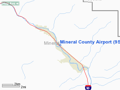
Location & QuickFacts
| FAA Information Effective: | 2008-09-25 |
| Airport Identifier: | 9S4 |
| Airport Status: | Operational |
| Longitude/Latitude: | 114-51-13.4680W/47-10-05.7340N
-114.853741/47.168259 (Estimated) |
| Elevation: | 2787 ft / 849.48 m (Estimated) |
| Land: | 70 acres |
| From nearest city: | 2 nautical miles SE of Superior, MT |
| Location: | Mineral County, MT |
| Magnetic Variation: | 18E (1985) |
Owner & Manager
| Ownership: | Publicly owned |
| Owner: | Mineral County |
| Address: | County Courthouse
Superior, MT 59872 |
| Phone number: | 406-822-3538 |
| Manager: | Gerald Geske |
| Address: | P.o. Box 517
Superior, MT 59872 |
| Phone number: | 406-822-4917 |
Airport Operations and Facilities
| Airport Use: | Open to public |
| Wind indicator: | Yes |
| Segmented Circle: | Yes |
| Control Tower: | No |
| Landing fee charge: | No |
| Sectional chart: | Great Falls |
| Region: | ANM - Northwest Mountain |
| Boundary ARTCC: | ZLC - Salt Lake City |
| Tie-in FSS: | GTF - Great Falls |
| FSS on Airport: | No |
| FSS Toll Free: | 1-800-WX-BRIEF |
| NOTAMs Facility: | GTF (NOTAM-d service avaliable) |
| Federal Agreements: | NGY |
Airport Communications
Airport Services
| Airframe Repair: | NONE |
| Power Plant Repair: | NONE |
| Bottled Oxygen: | NONE |
| Bulk Oxygen: | NONE |
Runway Information
Runway 12/30
| Dimension: | 3450 x 75 ft / 1051.6 x 22.9 m |
| Surface: | ASPH, Good Condition |
| Surface Treatment: | Porous Friction Course |
| Weight Limit: | Single wheel: 12000 lbs. |
| |
Runway 12 |
Runway 30 |
| Traffic Pattern: | Left | Left |
| Markings: | Basic, Good Condition | Basic, Good Condition |
| Obstruction: | 38 ft tree, 782.0 ft from runway, 198 ft right of centerline, 15:1 slope to clear | 25 ft trees, 830.0 ft from runway, 168 ft left of centerline, 25:1 slope to clear |
|
Radio Navigation Aids
| ID |
Type |
Name |
Ch |
Freq |
Var |
Dist |
| INE | NDB | Konna | | 521.00 | 17E | 19.2 nm |
| PLS | NDB | Polson | | 275.00 | 20E | 41.7 nm |
| MSO | VOR/DME | Missoula | 075X | 112.80 | 17E | 35.2 nm |
| MLP | VOR/DME | Mullan Pass | 125X | 117.80 | 20E | 36.7 nm |
Remarks
- PHONE ON FIELD.
- MOUNTAINOUS TERRAIN SURROUNDING AIRPORT.
- CONSTR PRIOR 1959.
Images and information placed above are from
http://www.airport-data.com/airport/9S4/
We thank them for the data!
| General Info
|
| Country |
United States
|
| State |
MONTANA
|
| FAA ID |
9S4
|
| Latitude |
47-10-05.734N
|
| Longitude |
114-51-13.468W
|
| Elevation |
2787 feet
|
| Near City |
SUPERIOR
|
We don't guarantee the information is fresh and accurate. The data may
be wrong or outdated.
For more up-to-date information please refer to other sources.
|
|


