 |
|
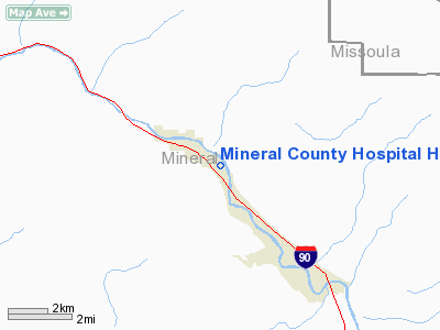
Mineral County Hospital Heliport |
Location & QuickFacts
| FAA Information Effective: | 2008-09-25 |
| Airport Identifier: | MT64 |
| Airport Status: | Operational |
| Longitude/Latitude: | 114-52-11.4700W/47-11-03.7360N
-114.869853/47.184371 (Estimated) |
| Elevation: | 2800 ft / 853.44 m (Estimated) |
| Land: | 0 acres |
| From nearest city: | 0 nautical miles N of Superior, MT |
| Location: | Mineral County, MT |
| Magnetic Variation: | 18E (1985) |
Owner & Manager
| Ownership: | Publicly owned |
| Owner: | County Hospital District |
| Address: | Po Box 66
Superior, MT 59872 |
| Phone number: | 406-822-4841 |
| Manager: | Madelyn L. Faller |
| Address: | Po Box 66
Superior, MT 59872 |
| Phone number: | 406-822-4841 |
Airport Operations and Facilities
| Airport Use: | Private
MEDICAL USE. |
| Segmented Circle: | No |
| Control Tower: | No |
| Sectional chart: | Great Falls |
| Region: | ANM - Northwest Mountain |
| Boundary ARTCC: | ZLC - Salt Lake City |
| Tie-in FSS: | GTF - Great Falls |
| FSS Toll Free: | 1-800-WX-BRIEF |
Runway Information
Helipad H1
| Dimension: | 25 x 25 ft / 7.6 x 7.6 m |
| Surface: | CONC, |
| |
Runway H1 |
Runway |
| Traffic Pattern: | Left | Left |
|
Radio Navigation Aids
| ID |
Type |
Name |
Ch |
Freq |
Var |
Dist |
| INE | NDB | Konna | | 521.00 | 17E | 20.1 nm |
| PLS | NDB | Polson | | 275.00 | 20E | 41.4 nm |
| MLP | VOR/DME | Mullan Pass | 125X | 117.80 | 20E | 35.6 nm |
| MSO | VOR/DME | Missoula | 075X | 112.80 | 17E | 36.2 nm |
Remarks
Images and information placed above are from
http://www.airport-data.com/airport/MT64/
We thank them for the data!
| General Info
|
| Country |
United States
|
| State |
MONTANA
|
| FAA ID |
MT64
|
| Latitude |
47-11-03.736N
|
| Longitude |
114-52-11.470W
|
| Elevation |
2800 feet
|
| Near City |
SUPERIOR
|
We don't guarantee the information is fresh and accurate. The data may
be wrong or outdated.
For more up-to-date information please refer to other sources.
|
|


