 |
|
Location & QuickFacts
| FAA Information Effective: | 2008-09-25 |
| Airport Identifier: | 0MT9 |
| Airport Status: | Operational |
| Longitude/Latitude: | 114-29-33.0000W/48-29-00.0000N
-114.492500/48.483333 (Estimated) |
| Elevation: | 3284 ft / 1000.96 m (Estimated) |
| Land: | 20 acres |
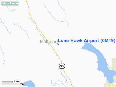
| From nearest city: | 11 nautical miles NW of White Fish, MT |
| Location: | Flathead County, MT |
| Magnetic Variation: | 18E (1995) |
Owner & Manager
| Ownership: | Privately owned |
| Owner: | Eric Sjoden |
| Address: | 1120 Lupfer Meadow Road
Whitefish, MT 59937 |
| Phone number: | 406-862-0025 |
| Manager: | Eric Sjoden |
| Address: | 1120 Lupfer Meadow Road
Whitefish, MT 59937 |
| Phone number: | 406-862-0025 |
Airport Operations and Facilities
| Airport Use: | Private |
| Wind indicator: | Yes |
| Segmented Circle: | No |
| Control Tower: | No |
| Sectional chart: | Great Falls |
| Region: | ANM - Northwest Mountain |
| Boundary ARTCC: | ZLC - Salt Lake City |
| Tie-in FSS: | GTF - Great Falls |
| FSS on Airport: | No |
| FSS Toll Free: | 1-800-WX-BRIEF |
Runway Information
Runway 12/30
| Dimension: | 1700 x 52 ft / 518.2 x 15.8 m |
| Surface: | TURF, |
| |
Runway 12 |
Runway 30 |
| Traffic Pattern: | Left | Left |
| Obstruction: | 75 ft trees, 200.0 ft from runway | 75 ft trees, 300.0 ft from runway |
|
Radio Navigation Aids
| ID |
Type |
Name |
Ch |
Freq |
Var |
Dist |
| SAK | NDB | Smith Lake | | 515.00 | 18E | 22.6 nm |
| EUR | NDB | Eureka | | 392.00 | 20E | 37.4 nm |
| LYI | NDB | Libby | | 414.00 | 17E | 41.4 nm |
| PLS | NDB | Polson | | 275.00 | 20E | 48.9 nm |
| FCA | VOR/DME | Kalispell | 079X | 113.20 | 18E | 20.5 nm |
Remarks
- ROUGH MEADOW STRIP CROSSES SEASONAL CREEK 8 1/2 WAY 52 FT CULVERT.
- TALL GRASS WET IN SPRING. FENCES & FOREST SURROUND STRIP.
- PRVDD VFR ONLY.
Images and information placed above are from
http://www.airport-data.com/airport/0MT9/
We thank them for the data!
| General Info
|
| Country |
United States
|
| State |
MONTANA
|
| FAA ID |
0MT9
|
| Latitude |
48-29-00.000N
|
| Longitude |
114-29-33.000W
|
| Elevation |
3284 feet
|
| Near City |
WHITE FISH
|
We don't guarantee the information is fresh and accurate. The data may
be wrong or outdated.
For more up-to-date information please refer to other sources.
|
|


