 |
|
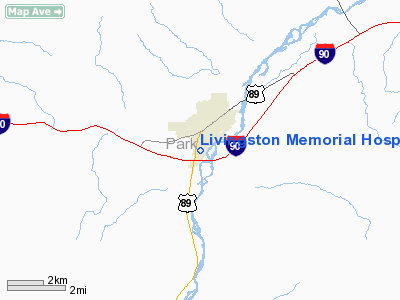
Livingston Memorial Hospital Heliport |
Location & QuickFacts
| FAA Information Effective: | 2008-09-25 |
| Airport Identifier: | MT66 |
| Airport Status: | Operational |
| Longitude/Latitude: | 110-34-07.7450W/45-38-56.7670N
-110.568818/45.649102 (Estimated) |
| Elevation: | 4487 ft / 1367.64 m (Estimated) |
| Land: | 0 acres |
| From nearest city: | 2 nautical miles S of Livingston, MT |
| Location: | Park County, MT |
| Magnetic Variation: | 16E (1985) |
Owner & Manager
| Ownership: | Privately owned |
| Owner: | Livingston Memorial Hospital |
| Address: | 504 South 13th Street
Livingston, MT 59047 |
| Phone number: | 406-222-3541 |
| Address: |
|
Airport Operations and Facilities
| Airport Use: | Private
MEDICAL USE. |
| Segmented Circle: | No |
| Control Tower: | No |
| Landing fee charge: | No |
| Sectional chart: | Great Falls |
| Region: | ANM - Northwest Mountain |
| Boundary ARTCC: | ZLC - Salt Lake City |
| Tie-in FSS: | GTF - Great Falls |
| FSS Toll Free: | 1-800-WX-BRIEF |
Runway Information
Helipad H1
| Dimension: | 30 x 30 ft / 9.1 x 9.1 m |
| Surface: | CONC, |
| |
Runway H1 |
Runway |
| Traffic Pattern: | Left | Left |
|
Radio Navigation Aids
| ID |
Type |
Name |
Ch |
Freq |
Var |
Dist |
| BZN | VOR/DME | Bozeman | 071X | 112.40 | 18E | 25.9 nm |
| LVM | VORTAC | Livingston | 108X | 116.10 | 15E | 6.2 nm |
Images and information placed above are from
http://www.airport-data.com/airport/MT66/
We thank them for the data!
| General Info
|
| Country |
United States
|
| State |
MONTANA
|
| FAA ID |
MT66
|
| Latitude |
45-38-56.767N
|
| Longitude |
110-34-07.745W
|
| Elevation |
4487 feet
|
| Near City |
LIVINGSTON
|
We don't guarantee the information is fresh and accurate. The data may
be wrong or outdated.
For more up-to-date information please refer to other sources.
|
|


