 |
|
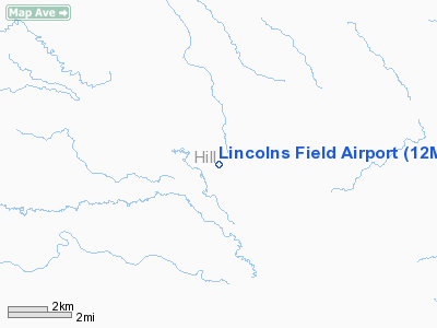
Location & QuickFacts
| FAA Information Effective: | 2008-09-25 |
| Airport Identifier: | 12MT |
| Airport Status: | Operational |
| Longitude/Latitude: | 110-26-29.8040W/48-46-26.9960N
-110.441612/48.774166 (Estimated) |
| Elevation: | 2931 ft / 893.37 m (Surveyed) |
| Land: | 0 acres |
| From nearest city: | 11 nautical miles S of Hingham, MT |
| Location: | Hill County, MT |
| Magnetic Variation: | 17E (1985) |
Owner & Manager
| Ownership: | Privately owned |
| Owner: | Roger Lincoln |
| Address: | Box 30
Gildford, MT 59525 |
| Phone number: | 406-355-4943 |
| Manager: | Roger Lincoln |
| Address: | Box 30
Gilford, MT 59525 |
| Phone number: | 406-355-4943 |
Airport Operations and Facilities
| Airport Use: | Private |
| Wind indicator: | Yes |
| Segmented Circle: | No |
| Control Tower: | No |
| Landing fee charge: | No |
| Sectional chart: | Great Falls |
| Region: | ANM - Northwest Mountain |
| Boundary ARTCC: | ZLC - Salt Lake City |
| Tie-in FSS: | GTF - Great Falls |
| FSS on Airport: | No |
| FSS Toll Free: | 1-800-WX-BRIEF |
Airport Services
| Airframe Repair: | NONE |
| Power Plant Repair: | NONE |
| Bottled Oxygen: | NONE |
| Bulk Oxygen: | NONE |
Runway Information
Runway 02/20
| Dimension: | 1780 x 55 ft / 542.5 x 16.8 m |
| Surface: | TURF, Poor Condition
UNDULATING & ROUGH. |
| |
Runway 02 |
Runway 20 |
| Traffic Pattern: | Left | Left |
| Obstruction: | 18 ft bldg, 135.0 ft from runway, 7:1 slope to clear | , 50:1 slope to clear |
|
Runway 16/34
| Dimension: | 1640 x 85 ft / 499.9 x 25.9 m |
| Surface: | TURF, Fair Condition
UNDULATING & ROUGH. |
| |
Runway 16 |
Runway 34 |
| Traffic Pattern: | Left | Left |
| Obstruction: | , 50:1 slope to clear | 18 ft bldg, 88.0 ft from runway, 4:1 slope to clear |
|
Radio Navigation Aids
| ID |
Type |
Name |
Ch |
Freq |
Var |
Dist |
| LTY | NDB | Chester | | 323.00 | 15E | 26.7 nm |
| LDS | NDB | Leeds | | 389.00 | 16E | 32.8 nm |
| HVR | VOR/DME | Havre | 055X | 111.80 | 16E | 30.1 nm |
Remarks
Images and information placed above are from
http://www.airport-data.com/airport/12MT/
We thank them for the data!
| General Info
|
| Country |
United States
|
| State |
MONTANA
|
| FAA ID |
12MT
|
| Latitude |
48-46-26.996N
|
| Longitude |
110-26-29.804W
|
| Elevation |
2931 feet
|
| Near City |
HINGHAM
|
We don't guarantee the information is fresh and accurate. The data may
be wrong or outdated.
For more up-to-date information please refer to other sources.
|
|


