 |
|
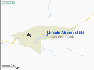
Location & QuickFacts
| FAA Information Effective: | 2008-09-25 |
| Airport Identifier: | S69 |
| Airport Status: | Operational |
| Longitude/Latitude: | 112-39-00.7800W/46-57-16.9300N
-112.650217/46.954703 (Estimated) |
| Elevation: | 4603 ft / 1402.99 m (Surveyed) |
| Land: | 110 acres |
| From nearest city: | 2 nautical miles E of Lincoln, MT |
| Location: | Lewis And Clark County, MT |
| Magnetic Variation: | 17E (1985) |
Owner & Manager
| Ownership: | Publicly owned |
| Owner: | Mt Aeronautics Division |
| Address: | Po Box 200507
Helena, MT 59620-0507 |
| Phone number: | 406-444-2506 |
| Manager: | Mt Aeronautics Division |
| Address: | Po Box 200507
Helena, MT 59620-0507 |
| Phone number: | 406-444-2506 |
Airport Operations and Facilities
| Airport Use: | Open to public |
| Wind indicator: | Yes |
| Segmented Circle: | Yes |
| Control Tower: | No |
| Lighting Schedule: | DUSK-DAWN
ACTVT MIRL RY 04/22 & PAPI RY 04 - CTAF. |
| Beacon Color: | Clear-Green (lighted land airport) |
| Landing fee charge: | No |
| Sectional chart: | Great Falls |
| Region: | ANM - Northwest Mountain |
| Boundary ARTCC: | ZLC - Salt Lake City |
| Tie-in FSS: | GTF - Great Falls |
| FSS on Airport: | No |
| FSS Toll Free: | 1-800-WX-BRIEF |
| NOTAMs Facility: | GTF (NOTAM-d service avaliable) |
| Federal Agreements: | NGY |
Airport Communications
Airport Services
| Airframe Repair: | NONE |
| Power Plant Repair: | NONE |
| Bottled Oxygen: | NONE |
| Bulk Oxygen: | NONE |
Runway Information
Runway 04/22
| Dimension: | 4239 x 75 ft / 1292.0 x 22.9 m |
| Surface: | ASPH, |
| Surface Treatment: | Porous Friction Course |
| Weight Limit: | Single wheel: 12500 lbs. |
| Edge Lights: | Medium
OTS INDEFLY. |
| |
Runway 04 |
Runway 22 |
| Longitude: | 112-39-26.0050W | 112-38-35.5570W |
| Latitude: | 46-57-05.1230N | 46-57-28.7340N |
| Elevation: | 4576.00 ft | 4603.00 ft |
| Alignment: | 56 | 0 |
| Traffic Pattern: | Left | Left |
| Markings: | Basic, Good Condition | Basic, Good Condition |
| Crossing Height: | 32.00 ft | 0.00 ft |
| VASI: | 2-light PAPI on left side
OTS INDEFLY. | |
| Visual Glide Angle: | 4.00° | 0.00° |
| Obstruction: | 73 ft trees, 1800.0 ft from runway, 70 ft right of centerline, 22:1 slope to clear
22:1 | 11 ft road, 475.0 ft from runway, 70 ft right of centerline, 25:1 slope to clear
25:1 |
|
Radio Navigation Aids
| ID |
Type |
Name |
Ch |
Freq |
Var |
Dist |
| CVP | NDB | Capitol | | 335.00 | 16E | 36.0 nm |
| HAU | NDB | Hauser | | 386.00 | 16E | 43.4 nm |
| DRU | VOR | Drummond | | 117.10 | 17E | 29.2 nm |
| HLN | VORTAC | Helena | 124X | 117.70 | 16E | 35.5 nm |
Remarks
- INTERMITTANT SNOW REMOVAL.
- PHONE ON FIELD.
- HEAVY HELICOPTER USE DURING SUMMER.
- TREES IN TRANSITION SFC BOTH SIDES OF RY FULL LENGTH.
Images and information placed above are from
http://www.airport-data.com/airport/S69/
We thank them for the data!
| General Info
|
| Country |
United States
|
| State |
MONTANA
|
| FAA ID |
S69
|
| Latitude |
46-58-29.787N
|
| Longitude |
112-38-41.138W
|
| Elevation |
4597 feet
|
| Near City |
LINCOLN
|
We don't guarantee the information is fresh and accurate. The data may
be wrong or outdated.
For more up-to-date information please refer to other sources.
|
|


