 |
|
| Liberty County Airport |
| IATA: none – ICAO: KLTY – FAA LID: LTY |
| Summary |
| Airport type |
Public |
| Owner |
Liberty County |
| Serves |
Chester, Montana |
| Elevation AMSL |
3,160 ft / 963 m |
| Coordinates |
48°30′39″N 110°59′27″W / 48.51083°N 110.99083°W / 48.51083; -110.99083 |
| Runways |
| Direction |
Length |
Surface |
| ft |
m |
| 7/25 |
4,607 |
1,404 |
Asphalt |
| 16/34 |
1,710 |
521 |
Turf |
| Statistics (2008) |
| Aircraft operations |
4,700 |
| Source: Federal Aviation Administration |
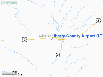
Liberty County Airport (ICAO: KLTY, FAA LID: LTY, formerly 4U3) is a county-owned, public-use airport located one nautical mile (1.85 km) west of the central business district of Chester, a town in Liberty County, Montana, United States.
Although most U.S. airports use the same three-letter location identifier for the FAA and IATA, this airport is assigned LTY by the FAA but has no designation from the IATA.
Facilities and aircraft
Liberty County Airport covers an area of 279 acres (113 ha) which contains two runways: 7/25 has a 4,607 x 75 ft (1,404 x 23 m) asphalt pavement and 16/34 has a 1,710 x 60 ft (521 x 18 m) turf surface. For the 12-month period ending August 24, 2008, the airport had 4,700 general aviation aircraft operations, an average of 12 per day.
The above content comes from Wikipedia and is published under free licenses – click here to read more.
Location & QuickFacts
| FAA Information Effective: | 2008-09-25 |
| Airport Identifier: | LTY |
| Airport Status: | Operational |
| Longitude/Latitude: | 110-59-27.1100W/48-30-38.6000N
-110.990864/48.510722 (Estimated) |
| Elevation: | 3160 ft / 963.17 m (Estimated) |
| Land: | 279 acres |
| From nearest city: | 1 nautical miles W of Chester, MT |
| Location: | Liberty County, MT |
| Magnetic Variation: | 14E (2005) |
Owner & Manager
| Ownership: | Publicly owned |
| Owner: | Liberty County |
| Address: | , Po Box 459
Chester, MT 59522 |
| Phone number: | 406-759-5365 |
| Manager: | Steve Layton |
| Address: | Liberty Co Airport
Chester, MT 59522 |
| Phone number: | 406-759-5187
OR CALL 759-5713 (SHOP) |
Airport Operations and Facilities
| Airport Use: | Open to public |
| Wind indicator: | Yes
SUPPLEMENTAL WINDCONE NE OF RY 07 THLD. |
| Segmented Circle: | Yes |
| Control Tower: | No |
| Lighting Schedule: | DUSK-DAWN
ACTVT MIRL RY 07/25 - CTAF. |
| Beacon Color: | Clear-Green (lighted land airport) |
| Landing fee charge: | No |
| Sectional chart: | Great Falls |
| Region: | ANM - Northwest Mountain |
| Traffic Pattern Alt: | 800 ft |
| Boundary ARTCC: | ZLC - Salt Lake City |
| Tie-in FSS: | GTF - Great Falls |
| FSS on Airport: | No |
| FSS Toll Free: | 1-800-WX-BRIEF |
| NOTAMs Facility: | GTF (NOTAM-d service avaliable) |
| Federal Agreements: | NGY |
Airport Communications
| CTAF: | 122.800 |
| Unicom: | 122.800 |
Airport Services
| Fuel available: | 100LL |
| Airframe Repair: | MAJOR |
| Power Plant Repair: | MAJOR |
| Bottled Oxygen: | NONE |
| Bulk Oxygen: | NONE |
Runway Information
Runway 07/25
| Dimension: | 4607 x 75 ft / 1404.2 x 22.9 m |
| Surface: | ASPH, Good Condition
HAS NUMEROUS GOPHER HOLES. |
| Surface Treatment: | Porous Friction Course |
| Weight Limit: | Single wheel: 12500 lbs. |
| Edge Lights: | Medium |
| |
Runway 07 |
Runway 25 |
| Traffic Pattern: | Left | Left |
| Markings: | Basic, Good Condition | Basic, Good Condition |
| Crossing Height: | 0.00 ft | 39.00 ft |
| VASI: | | 2-light PAPI on left side |
| Visual Glide Angle: | 0.00° | 3.00° |
| Obstruction: | , 50:1 slope to clear | 35 ft tree, 945.0 ft from runway, 191 ft left of centerline, 27:1 slope to clear |
|
Runway 16/34
| Dimension: | 1710 x 60 ft / 521.2 x 18.3 m |
| Surface: | TURF, Fair Condition
HAS NUMEROUS GOPHER HOLES. |
| |
Runway 16 |
Runway 34 |
| Traffic Pattern: | Left | Left |
| Obstruction: | 23 ft rr, 645.0 ft from runway, 28:1 slope to clear | , 50:1 slope to clear |
|
Radio Navigation Aids
| ID |
Type |
Name |
Ch |
Freq |
Var |
Dist |
| LTY | NDB | Chester | | 323.00 | 15E | 0.4 nm |
| SBX | NDB | Shelby | | 347.00 | 18E | 34.7 nm |
| CRD | NDB | Conrad | | 293.00 | 17E | 41.7 nm |
| HVR | VOR/DME | Havre | 055X | 111.80 | 16E | 48.6 nm |
Remarks
- PHONE ON FIELD.
- DEER & ANTELOPE INVOF ARPT.
Images and information placed above are from
http://www.airport-data.com/airport/LTY/
We thank them for the data!
| General Info
|
| Country |
United States
|
| State |
MONTANA
|
| FAA ID |
LTY
|
| Latitude |
48-30-38.600N
|
| Longitude |
110-59-27.110W
|
| Elevation |
3160 feet
|
| Near City |
CHESTER
|
We don't guarantee the information is fresh and accurate. The data may
be wrong or outdated.
For more up-to-date information please refer to other sources.
|
|


