 |
|
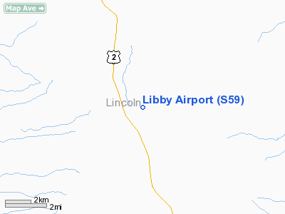
Location & QuickFacts
| FAA Information Effective: | 2008-09-25 |
| Airport Identifier: | S59 |
| Airport Status: | Operational |
| Longitude/Latitude: | 115-29-24.8830W/48-17-01.8430N
-115.490245/48.283845 (Estimated) |
| Elevation: | 2601 ft / 792.78 m (Surveyed) |
| Land: | 193 acres |
| From nearest city: | 7 nautical miles S of Libby, MT |
| Location: | Lincoln County, MT |
| Magnetic Variation: | 17E (2000) |
Owner & Manager
| Ownership: | Publicly owned |
| Owner: | City & County |
| Address: | 512 California Ave
Libby, MT 59923 |
| Phone number: | 406-293-7781 |
| Manager: | Keith Kinden |
| Address: | 4986 Farm To Market Rd
Libby, MT 59923 |
| Phone number: | 406-293-9776 |
Airport Operations and Facilities
| Airport Use: | Open to public |
| Wind indicator: | Yes |
| Segmented Circle: | Yes |
| Control Tower: | No |
| Lighting Schedule: | DUSK-DAWN
ACTVT MIRL RY 15/33 AND PAPI RYS 15 & 33 - CTAF. |
| Beacon Color: | Clear-Green (lighted land airport) |
| Landing fee charge: | No |
| Sectional chart: | Great Falls |
| Region: | ANM - Northwest Mountain |
| Boundary ARTCC: | ZSE - Seattle |
| Tie-in FSS: | GTF - Great Falls |
| FSS on Airport: | No |
| FSS Toll Free: | 1-800-WX-BRIEF |
| NOTAMs Facility: | GTF (NOTAM-d service avaliable) |
| Federal Agreements: | NGSY |
Airport Communications
| CTAF: | 122.800 |
| Unicom: | 122.800 |
Airport Services
| Fuel available: | 100LLA |
| Airframe Repair: | MAJOR |
| Power Plant Repair: | MAJOR |
| Bottled Oxygen: | NONE |
| Bulk Oxygen: | NONE |
Runway Information
Runway 15/33
| Dimension: | 5000 x 75 ft / 1524.0 x 22.9 m |
| Surface: | ASPH, Good Condition |
| Surface Treatment: | Porous Friction Course |
| Weight Limit: | Single wheel: 24000 lbs. |
| Edge Lights: | Medium |
| |
Runway 15 |
Runway 33 |
| Longitude: | 115-29-34.2480W | 115-29-15.4360W |
| Latitude: | 48-17-25.7100N | 48-16-37.9970N |
| Elevation: | 2582.00 ft | 2601.00 ft |
| Alignment: | 127 | 127 |
| Traffic Pattern: | Left | Left |
| Markings: | Basic, Good Condition | Basic, Good Condition |
| Crossing Height: | 28.00 ft | 36.00 ft |
| VASI: | 2-light PAPI on left side | 2-light PAPI on left side |
| Visual Glide Angle: | 3.00° | 3.75° |
| Obstruction: | 42 ft trees, 1683.0 ft from runway, 35:1 slope to clear
3-6 FT BERM 180 FT FM THR 71 FT R OF CNTRLN. | 72 ft trees, 2280.0 ft from runway, 215 ft right of centerline, 28:1 slope to clear |
|
Radio Navigation Aids
| ID |
Type |
Name |
Ch |
Freq |
Var |
Dist |
| LYI | NDB | Libby | | 414.00 | 17E | 1.3 nm |
| SAK | NDB | Smith Lake | | 515.00 | 18E | 42.6 nm |
| SZT | NDB | Sandpoe | | 264.00 | 20E | 42.9 nm |
| EUR | NDB | Eureka | | 392.00 | 20E | 43.8 nm |
Images and information placed above are from
http://www.airport-data.com/airport/S59/
We thank them for the data!
| General Info
|
| Country |
United States
|
| State |
MONTANA
|
| FAA ID |
S59
|
| Latitude |
48-17-01.843N
|
| Longitude |
115-29-24.883W
|
| Elevation |
2601 feet
|
| Near City |
LIBBY
|
We don't guarantee the information is fresh and accurate. The data may
be wrong or outdated.
For more up-to-date information please refer to other sources.
|
|


