 |
|
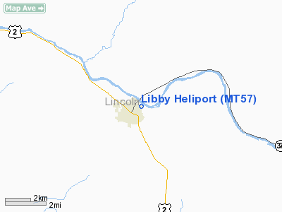
Location & QuickFacts
| FAA Information Effective: | 2008-09-25 |
| Airport Identifier: | MT57 |
| Airport Status: | Operational |
| Longitude/Latitude: | 115-32-43.0000W/48-23-34.0000N
-115.545278/48.392778 (Estimated) |
| Elevation: | 2072 ft / 631.55 m (Surveyed) |
| Land: | 1 acres |
| From nearest city: | 0 nautical miles NE of Libby, MT |
| Location: | Lincoln County, MT |
| Magnetic Variation: | 18E (1990) |
Owner & Manager
| Ownership: | Privately owned |
| Owner: | St Johns Luthern Hospital |
| Address: | 350 Louisiana Ave
Libby, MT 59923 |
| Phone number: | 406-293-0100 |
| Manager: | St Johns Luthern Hospital Maint Dep |
| Address: | 350 Louisiana Ave
Libby, MT 59923 |
| Phone number: | 406-293-0158 |
Airport Operations and Facilities
| Airport Use: | Private |
| Wind indicator: | Yes |
| Segmented Circle: | No |
| Control Tower: | No |
| Lighting Schedule: | DUSK-DAWN |
| Sectional chart: | Great Falls |
| Region: | ANM - Northwest Mountain |
| Boundary ARTCC: | ZSE - Seattle |
| Tie-in FSS: | GTF - Great Falls |
| FSS Toll Free: | 1-800-WX-BRIEF |
Runway Information
Helipad H1
| Dimension: | 50 x 50 ft / 15.2 x 15.2 m |
| Surface: | CONC, |
| |
Runway H1 |
Runway |
| Traffic Pattern: | Left | Left |
|
Radio Navigation Aids
| ID |
Type |
Name |
Ch |
Freq |
Var |
Dist |
| LYI | NDB | Libby | | 414.00 | 17E | 5.7 nm |
| EUR | NDB | Eureka | | 392.00 | 20E | 38.8 nm |
| SZT | NDB | Sandpoe | | 264.00 | 20E | 41.1 nm |
| SAK | NDB | Smith Lake | | 515.00 | 18E | 46.6 nm |
Remarks
- PRVDD TREES WITHIN 200' OF PROPOSED HELIPORT BE TRIMMED & MAINTAINED AT A HGT NOT TO EXCEED 15' AGL.
Images and information placed above are from
http://www.airport-data.com/airport/MT57/
We thank them for the data!
We don't guarantee the information is fresh and accurate. The data may
be wrong or outdated.
For more up-to-date information please refer to other sources.
|
|


