|
|
Lewistown Municipal Airport |
| Lewistown Municipal Airport |
 |
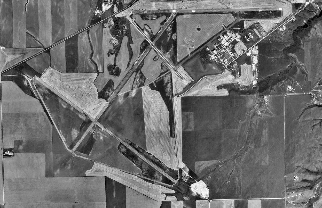
| USGS aerial image, 1997 |
| IATA: LWT – ICAO: KLWT – FAA LID: LWT |
| Summary |
| Airport type |
Public |
| Owner |
Lewistown & Fergus County |
| Serves |
Lewistown, Montana |
| Elevation AMSL |
4,170 ft / 1,271 m |
| Coordinates |
47°02′57″N 109°28′00″W / 47.04917°N 109.4666667°W / 47.04917; -109.4666667 |
| Runways |
| Direction |
Length |
Surface |
| ft |
m |
| 7/25 |
6,100 |
1,859 |
Asphalt |
| 2/20 |
5,600 |
1,707 |
Asphalt |
| 12/30 |
4,102 |
1,250 |
Asphalt |
| Statistics (2009) |
| Aircraft operations |
15,972 |
| Based aircraft |
46 |
| Source: Federal Aviation Administration |
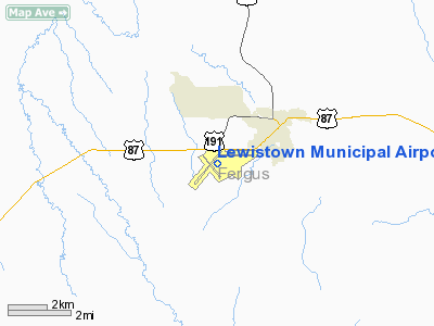
Lewistown Municipal Airport (IATA: LWT, ICAO: KLWT, FAA LID: LWT) is a public-use airport located two nautical miles (3.7 km) southwest of the central business district of Lewistown, a city in Fergus County, Montana, United States. It is owned by the City of Lewistown and Fergus County. This airport is included in the FAA's National Plan of Integrated Airport Systems for 2009–2013, which categorized it as a general aviation facility. It is also designated to receive commercial service subsidized by the federal Essential Air Service (EAS) program.
Scheduled air service at Lewistown ended on March 8, 2008, when Big Sky Airlines (the designated EAS operator) ceased operation. Great Lakes Airlines has been given USDOT approval to take over EAS service between Lewistown and Denver, Colorado. History
Lewiston Army Airfield was constructed during 1942 as one of four training facilities for B-17 Flying Fortress crew members and included a storage site for the top secret Norden Bombsight.
With construction complete, Lewistown was built as a satellite field for Great Falls Army Air Base. Squadrons were trained in the navigation of the B-17 in addition to receiving gunnery and bombing practice. Once their training was complete, the men were sent to the European front.
The airfield was in operation during a 12-month period between 1942 and 1943 and thereafter deactivated. The field was declared surplus in 1948 and has served the local community as a municipal airport ever since.
Facilities and aircraft
Lewistown Municipal Airport covers an area of 2,200 acres (890 ha) at an elevation of 4,170 feet (1,271 m) above mean sea level. It has three asphalt paved runways: 7/25 is 6,100 by 100 feet (1,859 x 30 m), 2/20 is 5,600 by 100 feet (1,707 x 30 m), and 12/30 is 4,102 by 60 feet (1,250 x 18 m).
For the 12-month period ending December 31, 2009, the airport had 15,972 aircraft operations, an average of 43 per day: 84% general aviation, 12% air taxi, and 4% military. At that time there were 46 aircraft based at this airport: 83% single-engine, 9% multi-engine, and 9% helicopter.
Airlines and destinations
| Airlines |
Destinations |
| Great Lakes Airlines |
Billings, Denver, Havre |
The above content comes from Wikipedia and is published under free licenses – click here to read more.
Location & QuickFacts
| FAA Information Effective: | 2008-09-25 |
| Airport Identifier: | LWT |
| Airport Status: | Operational |
| Longitude/Latitude: | 109-28-00.1000W/47-02-57.3000N
-109.466694/47.049250 (Estimated) |
| Elevation: | 4170 ft / 1271.02 m (Surveyed) |
| Land: | 2200 acres |
| From nearest city: | 3 nautical miles SW of Lewistown, MT |
| Location: | Fergus County, MT |
| Magnetic Variation: | 15E (1990) |
Owner & Manager
| Ownership: | Publicly owned |
| Owner: | Lewistown & Fergus Co |
| Address: | Box 343
Lewistown, MT 59457 |
| Phone number: | 406-538-5119 |
| Manager: | Jerry Moline |
| Address: | Box 343, 1650 Airport Rd, 1650 Airport Road
Lewistown, MT 59457 |
| Phone number: | 406-535-3264
OR CALL 406-350-3264. |
Airport Operations and Facilities
| Airport Use: | Open to public |
| Wind indicator: | Yes |
| Segmented Circle: | Yes |
| Control Tower: | No |
| Lighting Schedule: | DUSK-DAWN
ACTVT MIRL RYS 02/20 & 07/25; PAPI RY 07; VASI RY 25 AND REIL RYS 07 & 25 - CTAF. |
| Beacon Color: | Clear-Green (lighted land airport) |
| Landing fee charge: | No |
| Sectional chart: | Great Falls |
| Region: | ANM - Northwest Mountain |
| Boundary ARTCC: | ZLC - Salt Lake City |
| Tie-in FSS: | GTF - Great Falls |
| FSS Toll Free: | 1-800-WX-BRIEF |
| NOTAMs Facility: | LWT (NOTAM-d service avaliable) |
| Certification type/date: | III A S 12/20 |
| Federal Agreements: | NGPY3 |
Airport Communications
| CTAF: | 123.000 |
| Unicom: | 123.000 |
Airport Services
| Fuel available: | 100 A |
| Airframe Repair: | MAJOR |
| Power Plant Repair: | MAJOR |
| Bottled Oxygen: | NONE |
| Bulk Oxygen: | NONE |
Runway Information
Runway 02/20
| Dimension: | 5600 x 100 ft / 1706.9 x 30.5 m |
| Surface: | ASPH, Poor Condition
RY 02/20 ASPH SPALLING. |
| Weight Limit: | Single wheel: 12500 lbs.
Dual wheel: 80000 lbs.
Dual tandem wheel: 120000 lbs. |
| Edge Lights: | Medium |
| |
Runway 02 |
Runway 20 |
| Longitude: | 109-28-51.3807W | 109-28-01.6649W |
| Latitude: | 47-02-25.3516N | 47-03-08.9233N |
| Elevation: | 4170.00 ft | 4130.00 ft |
| Alignment: | 38 | 127 |
| Traffic Pattern: | Left | Left |
| Markings: | Basic, Poor Condition
RY 02/20 MARKINGS FADED. | Basic, Poor Condition
RWY MARKINGS FADED |
| Obstruction: | , 50:1 slope to clear | 34 ft bldg, 1647.0 ft from runway, 42:1 slope to clear |
|
Runway 07/25
| Dimension: | 6100 x 100 ft / 1859.3 x 30.5 m |
| Surface: | ASPH, Good Condition
RY 02/20 ASPH SPALLING. |
| Weight Limit: | Single wheel: 40000 lbs.
Dual wheel: 55000 lbs.
Dual tandem wheel: 95000 lbs. |
| Edge Lights: | Medium |
| |
Runway 07 |
Runway 25 |
| Longitude: | 109-28-10.4037W | 109-26-42.3278W |
| Latitude: | 47-03-10.8092N | 47-03-10.7907N |
| Elevation: | 4128.00 ft | 4112.00 ft |
| Alignment: | 90 | 127 |
| Traffic Pattern: | Left | Left |
| Markings: | Non-precision instrument, Fair Condition
07/25 EACH END HAS 1000 FT FIXED DISTANCE MARKERS. | Non-precision instrument, Fair Condition |
| Crossing Height: | 51.00 ft | 50.00 ft |
| VASI: | 2-light PAPI on left side | 4-box on left side |
| Visual Glide Angle: | 3.00° | 3.00° |
| Runway End Identifier: | Yes | Yes |
|
Runway 12/30
| Dimension: | 4102 x 60 ft / 1250.3 x 18.3 m |
| Surface: | ASPH, Good Condition
RY 02/20 ASPH SPALLING. |
| Weight Limit: | Single wheel: 12500 lbs. |
| |
Runway 12 |
Runway 30 |
| Longitude: | 109-28-33.2392W | 109-27-55.1453W |
| Latitude: | 47-03-06.5593N | 47-02-35.5715N |
| Elevation: | 4132.00 ft | 4163.00 ft |
| Alignment: | 127 | 127 |
| Traffic Pattern: | Left | Left |
| Markings: | Basic, Good Condition | Basic, Good Condition |
| Obstruction: | 17 ft rr, 702.0 ft from runway, 29:1 slope to clear | , 50:1 slope to clear |
|
Radio Navigation Aids
| ID |
Type |
Name |
Ch |
Freq |
Var |
Dist |
| LWT | NDB | Lewistown | | 353.00 | 17E | 3.0 nm |
| HWQ | NDB | Harlowton | | 242.00 | 17E | 39.9 nm |
| LWT | VORTAC | Lewistown | 057X | 112.00 | 15E | 5.7 nm |
Remarks
- ALL TWYS HAVE REFLECTORS.
- RY 02/20 DAY USE ONLY AND NOT PLOWED DURING SNOW.
- PRVD ALL ULTRALIGHTS FLY AT 300'AGL OR LESS WHEN IN CTLZ; AND MAINT A DSTC OF 500' OR GREATER FM THE CL OF ANY ACTV TXY/RWY, EXTD 2 MI FM THE ARPT & TO THE GND ON ANY ACTV RWY; ALL ULTRALIGHTS OPER OFF THE CLSD TXY TO RWY 11/29 ON S END. A LTR OF AGRMT IS FORMULATED BTN ARPT MGR & ZLC.
Images and information placed above are from
http://www.airport-data.com/airport/LWT/
We thank them for the data!
| General Info
|
| Country |
United States
|
| State |
MONTANA
|
| FAA ID |
LWT
|
| Latitude |
47-02-57.300N
|
| Longitude |
109-28-00.100W
|
| Elevation |
4170 feet
|
| Near City |
LEWISTOWN
|
We don't guarantee the information is fresh and accurate. The data may
be wrong or outdated.
For more up-to-date information please refer to other sources.
|
|