 |
|
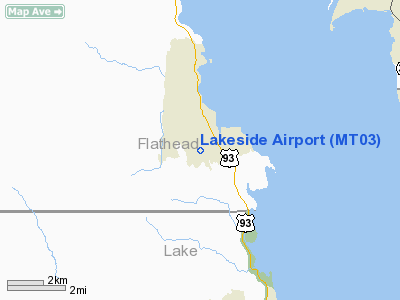
Location & QuickFacts
| FAA Information Effective: | 2008-09-25 |
| Airport Identifier: | MT03 |
| Airport Status: | Operational |
| Longitude/Latitude: | 114-13-27.5000W/47-59-36.2700N
-114.224306/47.993408 (Estimated) |
| Elevation: | 3440 ft / 1048.51 m () |
| Land: | 0 acres |
| From nearest city: | 2 nautical miles NW of Lakeside, MT |
| Location: | Flathead County, MT |
| Magnetic Variation: | () |
Owner & Manager
| Ownership: | Privately owned |
| Owner: | Montana Eagle Development Llc |
| Address: | 7135 Hwy 93 South
Lakeside, MT 59922 |
| Phone number: | 406-844-2091 |
| Manager: | Travor Schaefer
ALTERNATE AMGR IS MR. ROBERT MARTYN. |
| Address: | Montana Eagle Development Llc
Lakeside, MT 59922 |
| Phone number: | 406-844-2091 |
Airport Operations and Facilities
| Airport Use: | Private |
| Wind indicator: | Yes |
| Control Tower: | No |
| Region: | ANM - Northwest Mountain |
| Boundary ARTCC: | ZLC - Salt Lake City |
| Tie-in FSS: | GTF - Great Falls |
| FSS Toll Free: | 1-800-WX-BRIEF |
Airport Services
Runway Information
Runway 01/19
| Dimension: | 3376 x 60 ft / 1029.0 x 18.3 m |
| Surface: | ASPH, Good Condition |
| |
Runway 01 |
Runway 19 |
| Traffic Pattern: | Left | Left |
| Markings: | Basic, | Basic, |
|
Radio Navigation Aids
| ID |
Type |
Name |
Ch |
Freq |
Var |
Dist |
| SAK | NDB | Smith Lake | | 515.00 | 18E | 11.8 nm |
| PLS | NDB | Polson | | 275.00 | 20E | 18.0 nm |
| FCA | VOR/DME | Kalispell | 079X | 113.20 | 18E | 13.4 nm |
Remarks
Images and information placed above are from
http://www.airport-data.com/airport/MT03/
We thank them for the data!
We don't guarantee the information is fresh and accurate. The data may
be wrong or outdated.
For more up-to-date information please refer to other sources.
|
|


